UCAR congressional briefing highlights flood, drought prediction
Nation poised to make major advances in "water intelligence"
Sep 13, 2016 - by Staff
Early closure on July 3 and 4 - NSF NCAR Road, Parking Lot and Trails
View more information.Sep 13, 2016 - by Staff
WASHINGTON — The nation is poised to make major advances in "water intelligence" with more detailed forecasts of floods, streamflow, and potential drought conditions, a panel of experts said at a congressional briefing today.
The briefing, sponsored by the University Corporation for Atmospheric Research (UCAR), highlighted the new National Water Model, a comprehensive system for forecasting water resources from coast to coast. The technology underpinning the model, launched last month by the National Oceanic and Atmospheric Administration (NOAA), was developed by the National Center for Atmospheric Research (NCAR) and its collaborators at universities, the National Science Foundation and other federal agencies, and the private sector.
"The new forecast model is really a quantum leap forward and will help safeguard Americans from major floods and other precipitation events," said UCAR President Antonio J. Busalacchi, who introduced the panel. "It bridges the gap between research and operations, generating real-time forecasts to help vulnerable communities and protect lives and property."
UCAR manages NCAR on behalf of the National Science Foundation.
"Through a series of partnerships, it's possible to provide consistent, high-resolution, integrated water analyses, predictions, and data to address critical unmet information and service gaps," said Edward Clark, director of the Geo-Intelligence Office of Water Prediction at the NOAA National Water Center.
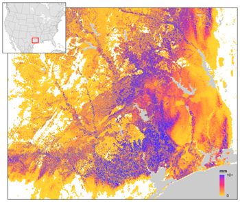
Unlike past streamflow models, which provided forecasts every few hours and only for specific points along major river systems, the new system continuously simulates conditions at 2.7 million locations along rivers, streams, and their tributaries across the contiguous United States. It paves the way for the biggest improvement in flood forecasting in the nation's history.
"The National Water Model provides a different way of thinking about continental hydrology by providing a view of a connected plumbing network from the mountains to the ocean," said panelist Richard Hooper, executive director of the Consortium of Universities for the Advancement of Hydrologic Science (CUAHSI). "Previously, hydrologists had considered river basins as discrete units rather than this river-continuum approach. This change in view opens up new areas of research that will improve our ability to predict not just floods but other aspects of water resources, including water quality and the impacts of droughts."
Thanks to ongoing research, the National Water Model is expected to provide increasingly detailed street-level forecasts, inundation maps, and additional features such as water quality forecasts. Scientists are working on incorporating more processes, such as soil saturation and the amount of water drawn up by vegetation.
"By dramatically increasing the geographic coverage as well as the lead times for forecasts, the National Water Model is ushering in a new era in flood and flash flood forecasting," said John McHenry, chief scientist of advanced meteorological systems for Baron Services. "Business, industry, and the general public will benefit through reduction in lost lives and property."
The panelists emphasized the importance of water resources to the major sectors of the U.S. economy. They warned that the nation is facing myriad water-related challenges ranging from growing demand to increasingly costly floods and droughts. Meeting those challenges will require continued coordination among research organizations, universities, the private sector, and federal, state, and local agencies.
"Beyond developing a new computer model, we're building a community by sharing resources, tools, and ideas," said NCAR scientist David Gochis. "The scientists are engaging with practitioners and decision makers to make the system as usable as possible."
The development team at NCAR worked with scientists at NOAA, the U.S. Geological Survey, and universities to adapt WRF-Hydro to serve as the first version of the National Water Model.
The panelists also discussed the need for better water intelligence among diverse communities across the country. For example, Ryan Emanuel, associate professor at North Carolina State University's Department of Forestry and Environmental Resources, noted that indigenous tribes across the nation are particularly vulnerable to drought and flooding for a range of cultural, historical, and economic reasons.
"Indigenous peoples across the United States are diverse, but one common theme is that water is sacred," said Emanuel, a member of the Lumbee Tribe of North Carolina. "It's not only critical for life, but it is life itself. Beyond the tools, the models, and the management lies the knowledge of the original inhabitants of this nation that water binds us all to a common fate."
The event is the latest in a series of UCAR congressional briefings about critical topics in the Earth system sciences. Past briefings have focused on predicting space weather, aviation weather safety, the state of the Arctic, hurricane prediction, and potential impacts of El Niño.