World's Largest Tornado Experiment Heads for Great Plains - Multimedia Gallery
May 4, 2009 - by Staff
Temporary impacts to NSF NCAR Road, Parking Lot and Trails
View more information.May 4, 2009 - by Staff
Multimedia Gallery
The largest and most ambitious tornado study in history, known as VORTEX2 (Verification of the Origins of Rotation in Tornadoes EXperiment 2), was conducted from May 10 to June 13, 2009, as dozens of scientists deployed radars and other ground-based instruments across the Great Plains to gain a better understanding of these often deadly weather events.

NCAR scientists and technicians will launch weather balloons at VORTEX2 with their Mobile GPS Advanced Upper-Air Sounding System. Shown here are (left to right) William Brown, Jennifer Standridge, and Tim Lim testing a balloon launch [ENLARGE] (Photo by Carlye Calvin.) News media terms of use*
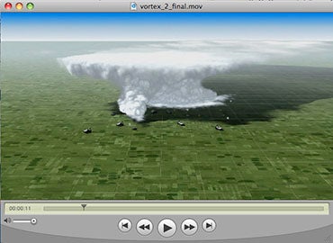
This one-minute animation (QuickTime) gives a 3-D overview of the VORTEX fleet, with descriptions of instruments as they might be deployed around a potentially tornadic thunderstorm.
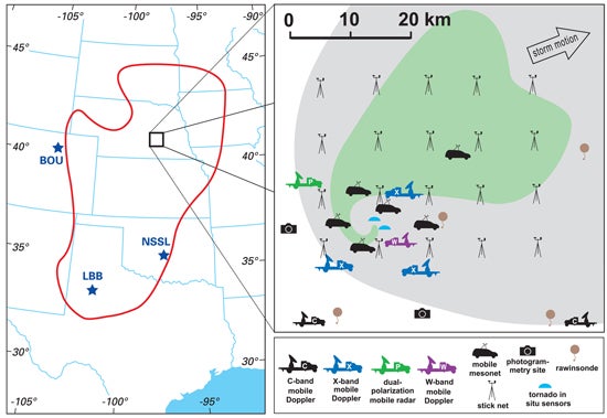
The VORTEX2 study area (left), shown as a red loop, stretches some 900 miles from north to south across the Great Plains. Shown at right is a supercell thunderstorm surrounded by VORTEX2 observing teams. The heaviest precipitation, in green, loops around the target area where a tornado might occur. (Image courtesy VORTEX2.) News media terms of use*