Accumulated wisdom: How to measure snow
Nov 14, 2011 - by Staff
Temporary impacts to NSF NCAR Road, Parking Lot and Trails
View more information.Nov 14, 2011 - by Staff
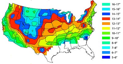
Average amount of snow per inch of water, 1971-2000. (Image by Marty Baxter, Saint Louis University, courtesy UCAR COMET Program.)
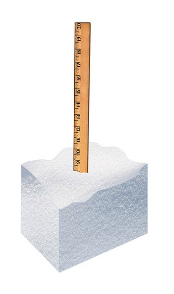
No matter how hard it’s snowing, those flakes don’t count as “measurable” unless they pile up to at least 0.1 inch (0.25 centimeters) on the ground. Otherwise, they merely count as a “trace.” That’s one of the many little-known facets of snow measurement as practiced by the National Weather Service (NWS), along with thousands of U.S. volunteers. Another noteworthy fact: an inch of water can produce widely varying amounts of snow.
To find out what separates fluff from cement, see the illustrations below.
For more on the challenges of measuring snow, see this feature story on How deep the snow? If you’ve got the urge to quantify and the taste for tromping in snow, consider volunteering as an observer with the NWS Cooperative Observer Program and/or CoCoRaHS (the Community Collaborative Rain, Hail and Snow Network).
The All About Snow site from the National Snow and Ice Data Center has lots of great background for volunteers and armchair observers alike, as does the CoCoRaHS page of Things to know about snow.
>>>Learn More
Winter storms & snowpack (NCAR Research Applications Lab)
Student & teacher resources on snowstorms & more (UCAR Center for Science Education)
Online training related to measuring snow (MetEd training from UCAR's COMET Program)
CoCoRaHS Snow Training Webinar (YouTube)
|
|
Using a typical 12-to-1 ratio of snow accumulation to moisture, an inch of water would produce 12 inches of snow. But the ratio varies in different parts of the country (see map, above) |
|
|
If snow forms and falls at temperatures near freezing, the flakes may be dense and clumpy. The snow-to-liquid ratio can be less than 10 to 1 and sometimes as low as 5 to 1, which means less snow for every inch of moisture. Warm ground can also melt some snow as it falls, further reducing accumulation. |
|
|
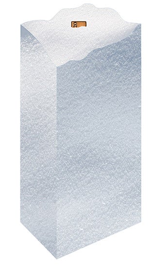
The fluffiest snow tends to form at cloud temperatures of around 4°F to 15°F (–15° to –9°C), when the flakes often have a classic branched appearance. These flakes are called dendrites. In ideal conditions, snow-to-liquid ratios can reach 20 to 1 or more. |
|
|
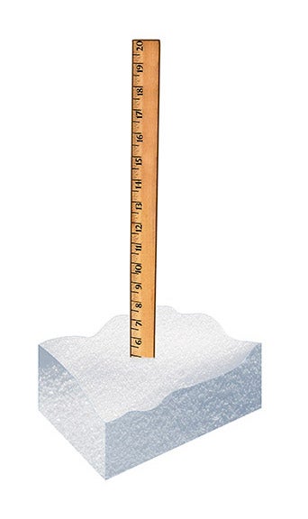
If snow forms at cloud temperatures well below 4°F (–15°C), the flakes often take the shape of prisms or needles. Compared to the fluffy dendritic flakes that form at warmer temperatures, prisms and needles are more dense, so accumulations may be somewhat lower. The depth of snow may also be lower if there are high winds, which can break flakes into smaller pieces that accumulate more densely. |
 |
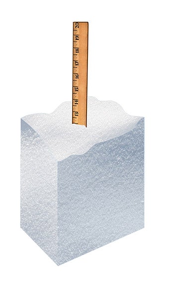
As snow falls on top of snow, the lower layers get compressed, reducing the total accumulation. This is especially true when dense, wet snow falls on top of a fluffier layer. |