New technology targets slick winter roads
Snowplows with customized sensors are monitoring weather, road conditions
Dec 17, 2013 - by Staff
Dec 17, 2013 - by Staff
BOULDER—In the annual battle to keep roads clear of snow and ice, snowplows are about to get much more intelligent.
Officials in three states this winter are deploying hundreds of plows with custom-designed sensors that continually measure road and weather conditions. The new digital intelligence system, funded by the U.S. Department of Transportation and built by the National Center for Atmospheric Research (NCAR), is designed to reduce accidents and save states millions of dollars in winter maintenance costs.
The system, known as the Pikalert™ Enhanced Maintenance Decision Support System (EMDSS), is being activated on major highways across Michigan, Minnesota, and Nevada. If it passes key tests, it will be transferred to private vendors and become available to additional states in time for next winter.
“This offers the potential to transform winter driving safety,” said NCAR scientist Sheldon Drobot, who oversees the design of the system. “It gives road crews an incredibly detailed, mile-by-mile view of road conditions. They can quickly identify the stretches where dangerous ice and snow are building up.”
The new system combines the sensor measurements with satellite and radar observations and computer weather models, giving officials an unprecedented near-real time picture of road conditions. With updates every five to fifteen minutes, EMDSS will enable transportation officials to swiftly home in on dangerous stretches even before deteriorating conditions cause accidents.
“The U.S. Department of Transportation is committed to addressing the safety and mobility problems associated with adverse weather, especially through the use of intelligent transportation systems,” said Kenneth Leonard, director of the Department of Transportation's Intelligent Transportation Systems Joint Program Office. “This effort demonstrates the value of connected vehicle technologies, advanced weather prediction, and targeted decision support to enable state departments of transportation to more effectively maintain a high level of service on their roads.”

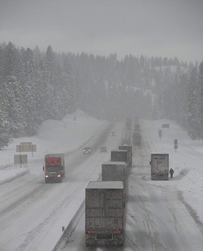
Cars and trucks facing heavy snow on Interstate 84 in Oregon. A new digital intelligence system that equips snowplows with custom-designed sensors is helping transportation officials clear winter roads more quickly and effectively. (Image courtesy Wikimedia Commons/Oregon Department of Transportation.)
Motor vehicle accidents involving wintry conditions and other hazardous weather claim the lives of more than 4,000 people in the United States and injure several hundred thousand each year. To keep roads clear, a single state can spend tens of millions of dollars on maintenance operations over the course of one winter.
But transportation officials often lack critical information about road conditions in their own states. They rely on ground-based observing stations that can be spaced more than 60 miles apart. As a result, they have to estimate conditions between weather stations. Snow and ice may build up more quickly along particular stretches of road because of shading, north-facing curves, higher elevation, or small-scale differences in weather conditions.
If officials dispatch snowplows unnecessarily, or treat roads with sand, salt, or chemicals when not needed, they risk wasting money and harming the environment. If they do not treat the roads, however, drivers may face treacherous conditions.
By equipping hundreds of snowplows and transportation supervisor trucks with sensors, officials can now get information along every mile of the roads traveled by the vehicles. The sensors collect weather data, such as temperature and humidity, as well as indirect indications of road conditions, such as the activation of antilock brakes or windshield wipers.
Using GPS technology, the measurements are coded with location and time. They are transmitted via the Internet or dedicated radio frequencies or cellular networks to an NCAR database, where they are integrated with other local weather data, traffic observations, and details about the road’s surface material. The resulting data are subjected to quality control measures to weed out false positives (such as a vehicle slowing down because of construction rather than slippery conditions).
The resulting detail about atmospheric and road conditions is relayed to state transportation officials to give them a near–real-time view of ice and snow buildup, as well as what to expect in the next few hours from incoming weather systems.
State transportation officials said the system will contribute significantly to safer roads.
"Collecting atmosphere and road surface condition data from vehicles in near-real time provides another important layer of information never before available,” said Steven Cook, operations/maintenance field services engineer of the Michigan Department of Transportation. “With information like this, we can more accurately pinpoint changing road conditions in the winter that need treatment and alert drivers of potential hazardous conditions before they encounter them."
“This additional location-specific information can help our maintenance crews provide a more effective and efficient response to weather events, resulting in improved road conditions and increased safety for all drivers,” added Denise Inda, the chief traffic operations engineer of the Nevada Department of Transportation.
Drobot said he is looking forward to evaluating EMDSS.
“We want to reduce that white-knuckle experience of suddenly skidding on ice,” Drobot said.
EMDSS is the leading edge of a revolutionary approach to keeping motor vehicles safer in inclement weather. The next step, as early as next summer, will be to begin providing information to drivers about potentially hazardous conditions in their immediate vicinity, alerting them to slow down or take alternate routes.
Several partners, including the universities of Nevada and Michigan and the firms Ameritrack and Synesis, relay information from the sensors to the main database at NCAR.
Pikalert™ is a trademark of the University Corporation for Atmospheric Research.