NSF NCAR technologies keep travelers on the move
Roads, runways are cleared with guidance from advanced weather models and AI
Dec 15, 2025 - by David Hosansky
Early closure on July 3 and 4 - NSF NCAR Road, Parking Lot and Trails
View more information.Dec 15, 2025 - by David Hosansky
| Impact Statement: Advanced computer models and tools developed at NSF NCAR guide transportation managers on how to treat roads and runways to keep travelers and goods safely on the move. |
As transportation officials work to keep the nation’s aviation and highway systems moving during winter storms, they are getting a boost from improved and expanded forecasts of pavement conditions.
At Denver International Airport — a major aviation hub and the nation’s third busiest airport — scientists at the U.S. National Science Foundation National Center for Atmospheric Research (NSF NCAR) are applying increasingly advanced computer models and artificial intelligence techniques to forecast snow and ice at specific points on runways. The forecasting system, first launched in 2008 and significantly upgraded in recent years, incorporates high-resolution weather models and AI-enhanced simulations of the slickness of runways.
The system has been so successful that airport officials and NSF NCAR have signed a five-year contract to continue work on it. The forecasts give maintenance crews both real-time updates and up to 72 hours of advance notice as they work to keep passengers safe and prevent flight delays or cancellations that could affect the aviation system from coast to coast.
“Having this centralized decision support system enables the maintenance officials to enhance their strategic planning,” said Seth Linden, an NSF NCAR software engineer who helped develop the system. “Thanks to AI and the latest developments in high-resolution weather modeling, it can provide more detail than ever for maintenance operations that keep the runways clear of snow and ice and make sure the airport stays open as it serves travelers nationwide and overseas.”
NSF NCAR experts have applied similar technologies for years to highways across Colorado and several other states. This year, they are building on those efforts with a demonstration project to forecast conditions along Interstate 70 from Ohio west to Utah, as well as along Interstate 75 from Ohio north to Michigan.
The forecasts will help state transportation officials target stretches of highway that can be threatened by weather conditions ranging from snow and cross winds to torrential rain or fog. It provides a consistent, uniform tool that will guide snow-clearing operations and hazardous weather alerts while facilitating coordinated efforts across state lines to keep traffic flowing.
“This is a multistate decision tool for officials to keep traffic safe and moving across one of the nation’s most important highway corridors,” said NSF NCAR scientist Curtis Walker. “Weather does not stop at a state’s borders, and neither does this system.”
The demonstration project is being launched under the auspices of a pooled fund transportation research partnership known as Aurora, which is led by state highway agencies in collaboration with Iowa State University. In addition to government agencies and universities, the partnership includes private sector companies that provide critical data for the forecasts or use them to alert their customers, including snowplow drivers and truckers, about fast-evolving weather conditions.
Both the aviation and highway forecasts use an NSF NCAR-based technology known as the Maintenance Decision Support System (MDSS®). First developed in 2001 with funding from the Federal Highway Administration, MDSS draws on highly localized observations from roadside weather stations and state vehicles such as snowplows, and inputs them into high-resolution weather models and a pavement heat balance model. This enables the system to predict both road surface and subsurface temperatures, as well as snow depths, at lead times that extend out to 72 hours.
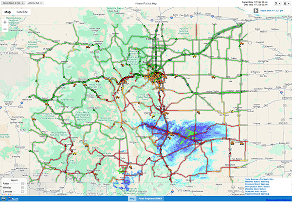
Building on MDSS, NSF NCAR subsequently developed a tactical system to make specific recommendations for treating winter roads. This system, named Pikalert®, combines observations and models in similar ways to MDSS, while issuing detailed alerts to state transportation departments every five minutes based on conditions that change rapidly during storms. In addition to keeping traffic moving safely, Pikalert can save a state transportation department several million dollars in a single winter by enabling it to apply chemicals and plow roads as efficiently as possible. It is currently in use in five states: Iowa, Colorado, Wyoming, Oregon, and Alaska.
Both systems operate as decision support tools, allowing officials to view weather and road information in a single place rather than needing to repeatedly check multiple observations and weather forecasts.
“The goal is to provide maintenance managers with high situational awareness of what’s going on, both in real time and in the future,” Linden said. “Automated, objective guidance is critical for the managers to get a handle on what actions need to be taken during significant weather events.”
To make the systems easier to use, the NSF NCAR team has made significant upgrades in recent years, including developing easy-to-use graphical interfaces that can be assessed remotely on smartphones. The team is also incorporating increasingly high-resolution weather models, giving maintenance crews more fine-scale predictions about pavement conditions.
Now the scientists are focusing on developing AI techniques to further improve safety.
In a significant advance, the team has successfully trained Pikalert to automatically diagnose current weather and road conditions from traffic camera data feeds. This has required a machine learning approach so that Pikalert can accurately interpret visual images, differentiating between road hazards such as accumulating snow from harmless features such as white construction vehicles parked in the highway median.
Scientists have also developed a specialized friction model by using AI techniques to identify correlations between atmospheric conditions and the build-up of liquid or frozen moisture on pavement. The new model is a more efficient way of alerting officials to potentially dangerous slick patches than the traditional method of measuring drag by towing a friction wheel behind a truck.
Looking to the future, scientists expect to further enhance MDSS and Pikalert as automated trucks and cars become more common. The sensors of such vehicles, which gather comprehensive information about traffic and weather conditions, can fill in the gaps between roadside weather stations.
“As these systems get more advanced, they will enable transportation managers and maintenance crews to be increasingly proactive in taking necessary actions that may range from closing highways or activating variable speed limits to treating road surfaces with appropriate chemicals,” Walker said. “In time, we hope to see a uniform, nationwide system that deploys these systems to support economic prosperity, commerce, and safety.”