Geoscience data services to expand with NSF sponsorship
UCAR's Unidata program will tap cloud-computing technologies
Apr 17, 2014 - by Staff
Apr 17, 2014 - by Staff
BOULDER—A program that provides unique data support to geoscientists worldwide will expand its services over the next five years, under a renewal of its grant with the National Science Foundation (NSF).
Unidata, managed by the University Corporation for Atmospheric Research (UCAR), provides atmospheric science data to university departments in near real time. Its services encompass a wide range of cyberinfrastructure technologies that make geoscience data more useful and accessible for scientists and educators at more than 3,000 educational, government, and research institutions worldwide, including 700 U.S. universities.

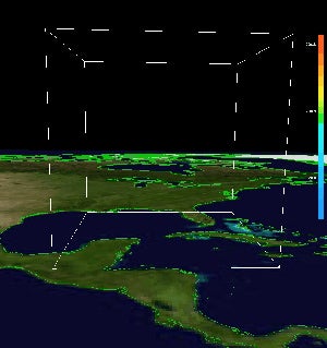
This 3-D depiction of the flow in and around 2008's Hurricane Gustav was created using Unidata's Integrated Data Viewer. Click on image to animate. (Visualization courtesy Unidata.)
Under the new award with NSF of up to $25 million, Unidata will tap emerging technologies to better serve the geoscience community. This includes using cloud computing in ways that will enable researchers worldwide to access data and collaborate more effectively with colleagues at distant organizations and across scientific disciplines in order to tackle major scientific challenges.
“We’re working to leverage the advantages of and advances in cloud-based computing paradigms that have emerged and become robust in recent years,” said Unidata director Mohan Ramamurthy. “The goal is to help advance scientific understanding of the physical world by better enabling scientists to extract knowledge from a deluge of observations and other data.”
By gathering information into a cloud environment, the Unidata approach will also reduce the amount of data that must be transferred over computer networks and ease the computing requirements at universities and other research organizations.
Unidata focuses on enabling scientists to better access, analyze, and integrate large amounts of data. It has also developed sophisticated tools to visualize information.
Although Unidata’s core activities focus on serving scientists and educators in the atmospheric and related sciences, virtually every project that Unidata undertakes has a broader impact on the geosciences community and society at large. Unidata-developed cyberinfrastructure is in wide use among U.S. federal agencies, private industry, and non-governmental and international organizations, including the National Oceanic and Atmospheric Administration, the Department of Energy, Department of Defense, and NASA.
More than 100,000 university students across the country are expected to use Unidata’s products and services, and hundreds of scholarly articles reference Unidata annually.
Professors and other Unidata users said its services are critical for geoscience education and research.
“Unidata provides the superhighway needed to connect my students to critical weather observations used for education and teaching in the atmospheric and related sciences,” said Jim Steenburgh, professor of atmospheric sciences at the University of Utah.
At Millersville University, scientists and education experts in the Earth Sciences and Computer Science departments used a Unidata analysis and visualization tool to create a 3-D virtual immersion experience known as GEOpod. This allows the user to navigate a virtual probe within a computer simulation of the atmosphere, capturing temperature, humidity, and other parameters while using navigational aids and tracking capabilities.
"With the help of Unidata, we can essentially bring students into a numerical weather model, helping them better understand the actual atmosphere as well as the modeling process,” said Richard Clark, chairman of the Earth Sciences Department at Millersville University.
Unidata is a community data and software facility for the atmospheric and related sciences, established in 1984 by U.S. universities with sponsorship from NSF.