Drones need aviation forecasts, too
NCAR scientists direct their weather expertise to UAS needs
Apr 13, 2017 - by Laura Snider
Early closure on July 3 and 4 - NSF NCAR Road, Parking Lot and Trails
View more information.Apr 13, 2017 - by Laura Snider
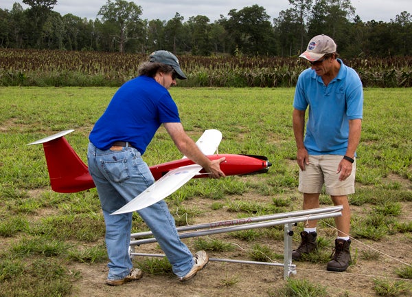
The possible future uses for drones are spectacularly diverse. Unmanned aircraft systems (UAS) could make door-to-door deliveries, search for a lost hiker, survey agricultural crops, inspect infrastructure, or collect scientific data from difficult-to-reach places, among other things.
Already Amazon is experimenting with drone delivery of packages, for example, and BNSF Railway is testing the use of drones to inspect hundreds of miles of railroad tracks.
Yet the ultimate success of efforts like these may hinge on a good weather forecast.
The National Center for Atmospheric Research (NCAR), long a trusted provider of critical weather information to the aviation industry, is beginning to lend its expertise to the UAS community as well.
Staff in NCAR's Research Applications Laboratory are already working with NASA to provide low-level turbulence forecasts for NASA's project to create a UAS Traffic Management (UTM) system, which would be similar to the air traffic control system for crewed airplanes. And in May, the NCAR team is hosting a UAS Weather Forum in Dallas. The forum will be co-located with XPONENTIAL, a conference on "all things unmanned" that is organized by the Association of Unmanned Vehicle Systems International.
"As the aircraft get smaller and smaller, the challenges of providing the needed weather information increase," said NCAR scientist Matthias Steiner, deputy director of RAL's Aviation Applications Program. "These small UAS's are more sensitive to winds, temperature, turbulence, precipitation — essentially the full range of weather — than larger planes flying at higher altitudes."
Weather impacts on drones
Drones, at least the small ones allowed under current Federal Aviation Administration rules, fly in the lowest few hundred feet of the atmosphere, where weather can be highly dynamic and less predictable.
This layer of the atmosphere is heavily affected by land surface and topography. Consider, for example, wind as it blows through a city. The buildings force the wind to speed through "urban canyons" and swirl into tight eddies behind structures. Uneven heating — the sunny side of the street warming more than the shady side, for example — can create circulating downdrafts and updrafts.
Piloting a drone through a built-up area could be tricky without a detailed understanding of the local atmospheric circulation patterns. And even with that information, it's important to understand how different drones will be affected. The tinier and lighter the drone, the more vulnerable it is to the vagaries of the weather, just as a small Cessna is more vulnerable to turbulence than a giant 747. And the type of drone, such as a fixed wing or a quadcopter, matters as well because each has a different ability to respond.
The concern is not just crashing on the ground; severe weather conditions could also lead to a collision in the sky. NASA's UTM project is exploring the possibility of managing a high volume of drones by essentially assigning individual UAS's to a lane of airspace. But weather will affect the ability of a drone to stay in its lane. An abrupt updraft, for instance, could force a drone that is supposed to fly at a lower altitude into the higher-altitude lane assigned to another UAS (or a crewed aircraft in mixed airspace), increasing the possibility of a collision between the two.
Weather can have less obvious impacts on drone operation as well. Extremely cold weather, headwinds, or turbulence that requires a lot of flight control adjustments could drain the aircraft's battery more quickly, reducing its range and, potentially, its ability to return home.
These kinds of weather challenges would likely not surprise a seasoned aviator. But many of the organizations interested in using drones today come to the UAS community from the technology side, not the aviation side, and may lack a full understanding of the impacts that atmospheric conditions can have on flight.
This is where NCAR has expertise to offer. For decades, NCAR has been providing the aviation industry with the tools they need to increase flight safety, including wind shear alerts, turbulence forecasts, and information on inflight icing potential.
In an effort to stay on top of the latest weather challenges facing the aviation industry, NCAR launched the Friends and Partners in Aviation Weather Forum in 1997. The meeting, now held twice yearly, is an opportunity for stakeholders from the operational, regulatory, and research sectors to come together.
"We created these meetings as a means of fostering dialogue," Steiner said. "We want to know: 'What are your operational sensitivities? How can we help you?' Now we are emulating these forums with the UAS community. "
The UAS Weather Forum at the XSPONENTIAL conference on May 8 is the first effort at starting a similar meeting—and fostering the dialogue needed to advance drone safety, even in the face of challenging weather conditions.
"We want drone operators to know NCAR is a partner that can help them address their weather impacts," Steiner said.