Boulder’s winds aren’t what they used to be
Extreme gusts in Boulder and Front Range appear to be diminishing
Jun 24, 2025 - by David Hosansky
Temporary impacts to NSF NCAR Road, Parking Lot and Trails
View more information.Jun 24, 2025 - by David Hosansky
| Impact Statement: Peak wind gusts in Boulder have diminished from decades ago, when they often topped 120 mph and caused widespread structural damage. |
Peak wind gusts in Boulder and possibly other locations along the Front Range don’t pack the same punch they used to, according to a new analysis led by scientists at the U.S. National Science Foundation National Center for Atmospheric Research (NSF NCAR).
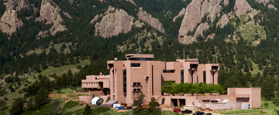
Throughout the 1960s, 1970s, and 1980s, wind gusts routinely topped 120 miles per hour (mph), as measured at NSF NCAR’s Mesa Lab in the foothills above southwest Boulder. But the city’s extreme downslope winds have seemingly slackened in the last 30 years, with observed peak gusts rarely approaching 100 mph after 1995.
The winds are highly destructive, causing widespread structural damage and driving wildfires, and the research team wanted to find out if the gusts have really weakened or if the difference has to do with changes in how they’re observed. Their analysis highlighted the surprising challenges of determining how wind speeds change over time.
“We had to engage in some detective work to see if the extreme wind gusts have really decreased or if this had to do with other factors, such as how they’re measured,” said NSF NCAR scientist Gerald Meehl, the lead author of the new study. “It turns out that there has been a diminishing of peak gusts, but we still need to determine why that’s the case.”
Even the diminished winds can still lead to disaster. On December 30, 2021, gusts of up to 112 mph — the first peak gusts above 100 mph since 1995, as measured at the Mesa Lab — drove the catastrophic Marshall Fire through communities east of Boulder, destroying nearly 1,100 structures.
The new study, published in the Bulletin of the American Meteorological Society, was co-authored by scientists at NSF NCAR, the University of Colorado Boulder, the University of Washington, NVIDIA, and the National Weather Service at NOAA. It was funded by the U.S. Department of Energy and NSF.
Situated just east of the Rocky Mountains, Boulder is often buffeted by powerful winds that are generated by upper-level westerlies rushing down from the Continental Divide to the city, especially in winter. A windstorm in January 1969 packed peak gusts of 130 mph, spreading numerous fires and killing a fireman who was blown off the back of a fire truck that was racing to fight a wind-driven fire. Just 2 years later, a peak gust of 147 mph was recorded at the NSF NCAR Mesa Lab, and in 1982 a windstorm with gusts up to 137 mph damaged at least 40% of the buildings in Boulder.
Although local newspaper accounts of severe gusts go back to the 19th century, damaging windstorms have become much rarer since the 1990s. Part of the reason may have to do with new building codes making structures more resilient, as well as with the growth of trees that may help mitigate extreme gusts near ground level.
But the scientists suspected that the actual wind gusts may have changed. While the observational records indicated the gusts had weakened, the measurements came with a significant asterisk: they were largely based on anemometer readings at the Mesa Lab, which sits hundreds of feet above the city at an elevation of 6,184 — the epicenter of extreme downslope windstorms. However, both the placement and technology of the building’s anemometers have changed over the years.
When the Mesa Lab opened in 1967, scientists who knew about Boulder’s long-time history of powerful winds mounted a propeller anemometer to the top of a 10-meter tower. In 1996, that was replaced with a newer, sonic anemometer mounted on a mast just two meters above roof level. To quantify the effects of the change in instrument and location, scientists in 2017 installed a different type of sonic anemometer at the same location where the propeller anemometer had been installed decades earlier.
A comparison during the three-year period of 2021-2023 showed that extreme gusts were 10-16% stronger when measured by the anemometer on top of the 10-meter mast compared with the one lower down. This showed that moving the location of the anemometer in 1996 could account for some, but not all, of the reduction in measured peak gusts. Even with a 16% adjustment, the strongest post-1996 gusts of 100 mph still clocked in well below the pre-1996 period, which saw gusts in seven windstorms exceeding 117 mph.
The research team also looked at NOAA wind reports from other anemometers along the Front Range. Although those measurements only go back only to the mid 1990s, they showed a reduction in peak wind gusts as well.
Additional evidence for the weakening of peak gusts came from an analysis that the scientists conducted of hourly wind data from the European Centre for Medium-Range Weather Forecasts. This indicated that a large-scale decrease in lower atmospheric winds had occurred since the 1990s.
More research is needed to flesh out the reason for the decrease in peak gusts. But the paper suggests it may have to do with changes in atmospheric conditions. As global temperatures have become warmer, tropical storms are pumping more heat high in the atmosphere, affecting upper-level winds in the midlatitudes that could be changing the combination of atmospheric ingredients that produce strong wind gusts during powerful downslope wind events.
“The difference in instrument location is part of the story, but the bigger picture probably has to do with changing conditions in the atmosphere,” Meehl said. “The next step in the research is to figure out why peak gusts are diminishing, which should help us anticipate the future prospects of these destructive wind events.”