When it comes to collecting data, nothing stops NCAR scientific teams
M2HATS field study continues in spite of flooding, arachnids, and a logistical time crunch
Nov 1, 2023 - by Audrey Merket
Early closure on July 3 and 4 - NSF NCAR Road, Parking Lot and Trails
View more information.Nov 1, 2023 - by Audrey Merket
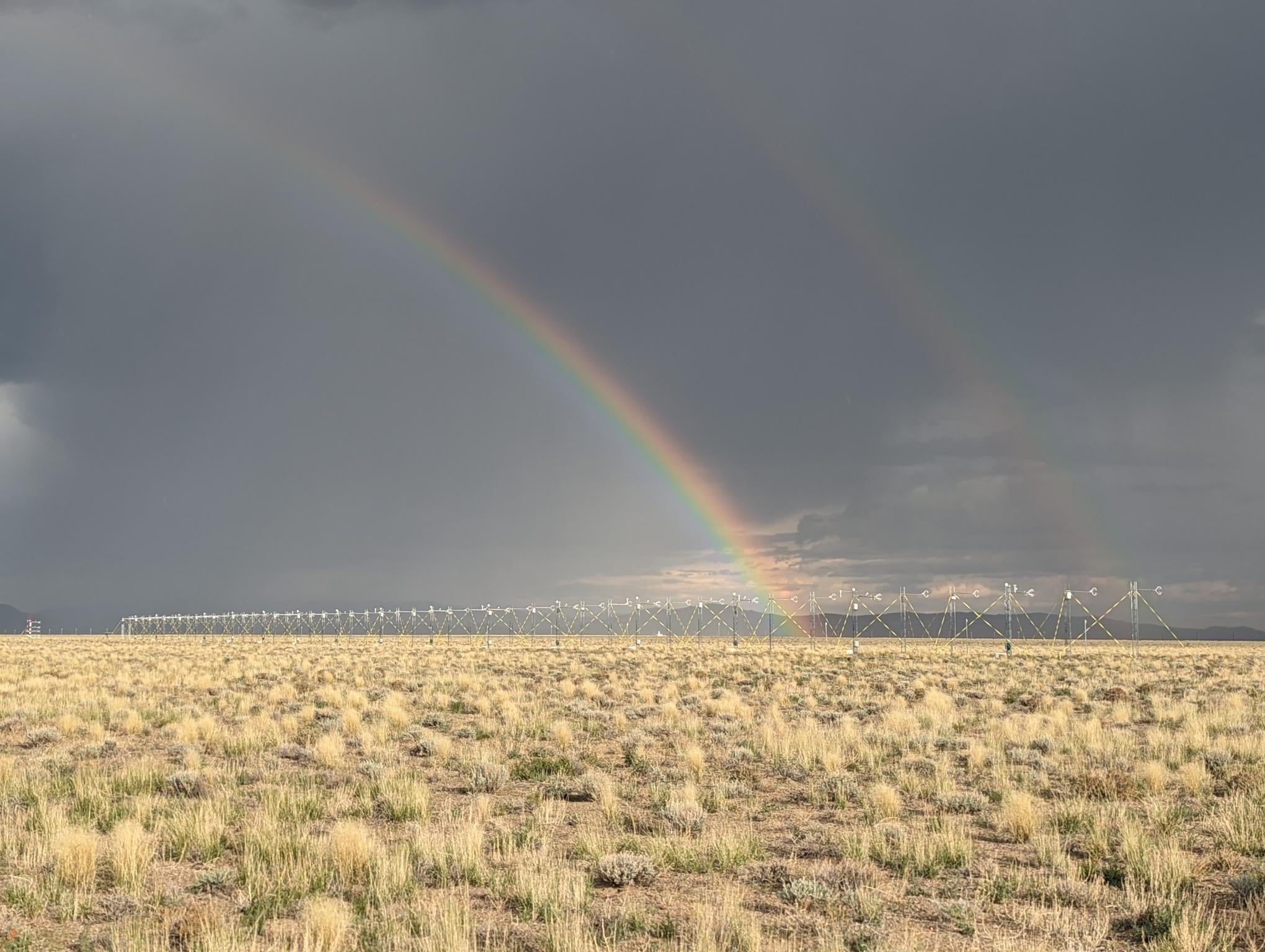
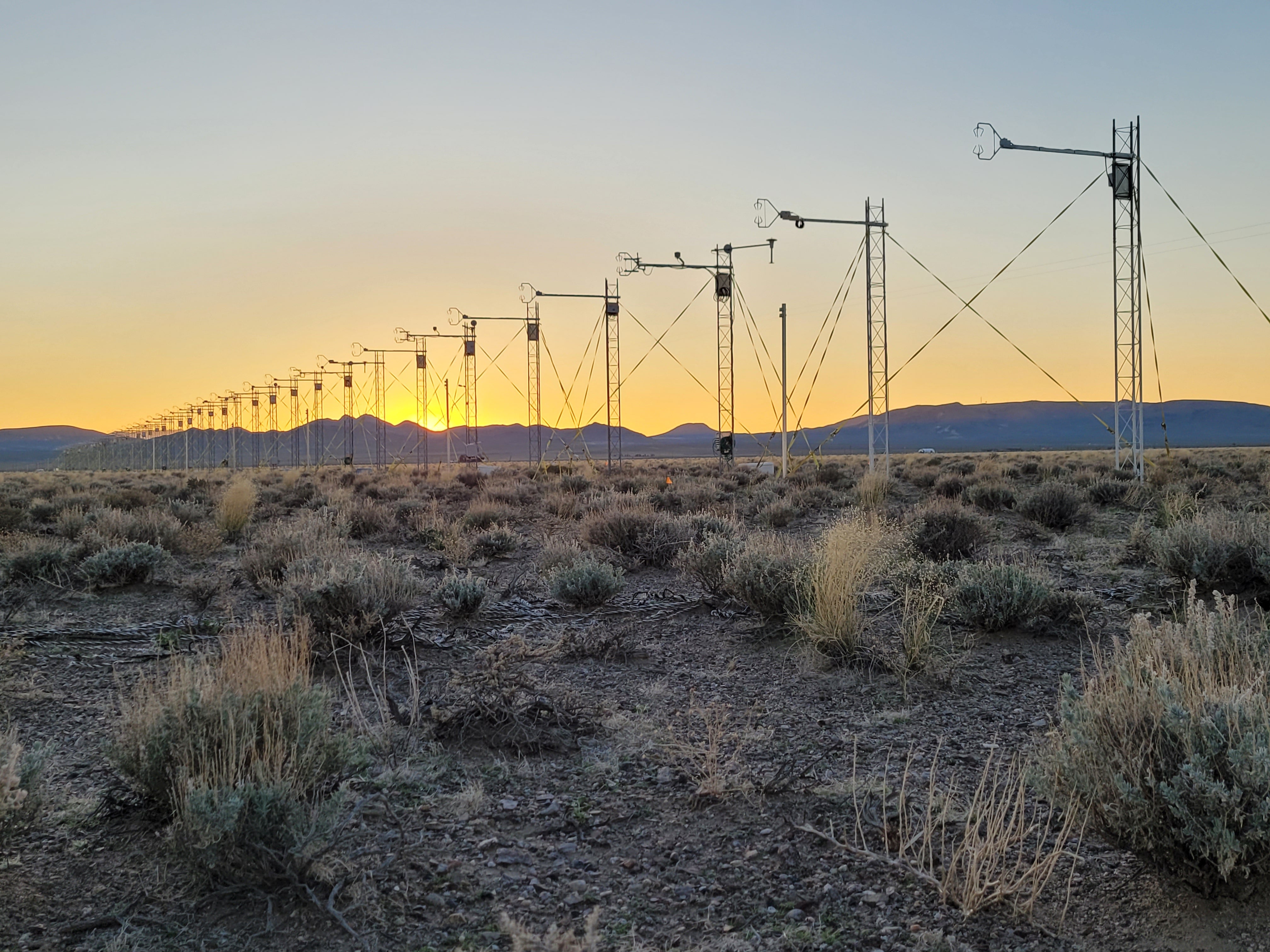
Rainbows over the M2HATS field site. (Image: Stephan De Wekker/University of Virginia)
Lake Tulare had been dormant for decades, so no one thought twice about planting fields of cotton and tomatoes, building homes and roads, or planning a research study in the dry basin near Kettleman, California. But when record snow and rainfall in May 2023 led to the reemergence of the lake and widespread flooding, the field site for an Earth Observing Laboratory (EOL) study was one of many casualties. The researchers were faced with the choice of postponing the study for a year or scrambling to find a new location.
The COVID-19 pandemic forced a two-year break in field programs for EOL, a lab at the U.S. National Science Foundation (NSF) National Center for Atmospheric Research (NCAR). When EOL staff returned in early 2022, they enthusiastically began working on the growing list of requested field projects. The Multi-point Monin-Obukhov similarity horizontal array turbulence study, or M2HATS, was one of those proposals.
M2HATS was scheduled to take place at a site near Kettleman where researchers aimed to collect a vast amount of meteorological data that they believed could improve how models simulate turbulence, and as a result, severe weather. Staff had already spent nine months arranging land leases, utilities, and equipment shipments for the field site when Lake Tulare reappeared. The researchers did not want any more delays and tenaciously set about finding a new location.
“No one said let’s postpone a year. The staff was incredibly flexible and had great attitudes,” said Terry Hock, EOL In-Situ Sensing Facility manager. “Everyone was committed to the research and did what it took to ensure the program was successful.”
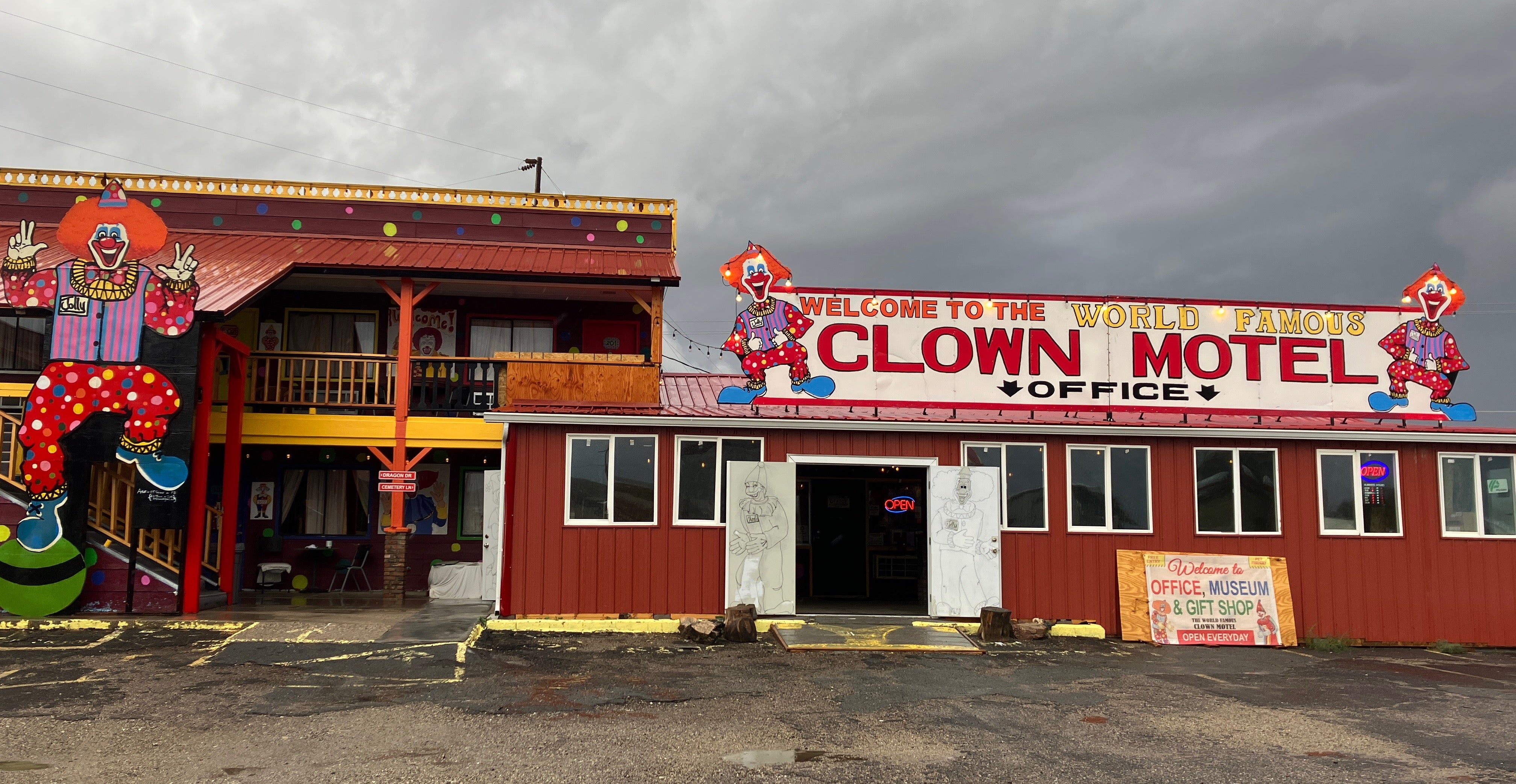
To move forward, the research team needed to find a new location that was climatologically similar to the site in California. Land near the airport in Tonopah, Nevada, was deemed a match for the study due to high heat and consistent wind in the area. Right away, scientists began arranging land leases, working with utilities, and rerouting equipment shipments to this small town that is home to “The World Famous Clown Motel” (notorious for its collection of more than 3,000 clowns).
Finding a new location was only the first “hiccup,” as one staff member optimistically called the complications the project encountered. While the airport owner and city officials were supportive of the project, it still needed authorization from the Board of County Commissioners. This was EOL scientist Steve Oncley’s final project before retiring, and he was particularly determined to make the project successful. He flew out to attend city and county board meetings, delivering presentations that translated complex scientific concepts into easily understandable language.
Initially, the commissioners voted in favor of the project, but when rumors spread throughout the county that the project would lead to the installation of large wind farms, the fate of the project seemed tenuous once again. Scientists readdressed the board, this time with a letter from Scott McIntosh, NCAR deputy director of administration and strategic implementation. They reassured the board that the project had nothing to do with the installation of wind turbines or development of a wind energy program but was essential to the field of meteorology in leading to more accurate forecasting of severe weather events like tornadoes. The project received final approval only days before researchers began collecting data.
Originally, staff planned to begin setting up equipment in early June, but due to the location change and logistic delays, the set up did not begin until mid July in Tonopah. At that point, temperatures frequently soared over 100 degrees Fahrenheit. Undeterred, the crew started work early every morning, taking breaks during the heat of the day and resuming their operations as it cooled off in the late afternoon. The diligence of NCAR staff kept the project on track.
Led by Chenning Tong of Clemson University and Shane Mayor of California State University, Chico, M2HATS sought to collect data that will be used to improve the way atmospheric models represent turbulence. Almost all of today’s atmospheric models rely on a mathematical theory called the Monin-Obukhov similarity theory to estimate the extremely complex interactions that occur at the interface between the atmosphere and Earth’s surface as wind blows across the land’s sometimes bumpy and rough features. This theory has been fundamental to our ability to model and predict weather. However, it has limitations, including its capacity to represent varied terrain. Tong has developed enhancements to the theory that he has dubbed the multipoint Monin-Obukhov similarity theory, which he proposes could improve model accuracy, but needed atmospheric observations at the earth’s surface to prove it.
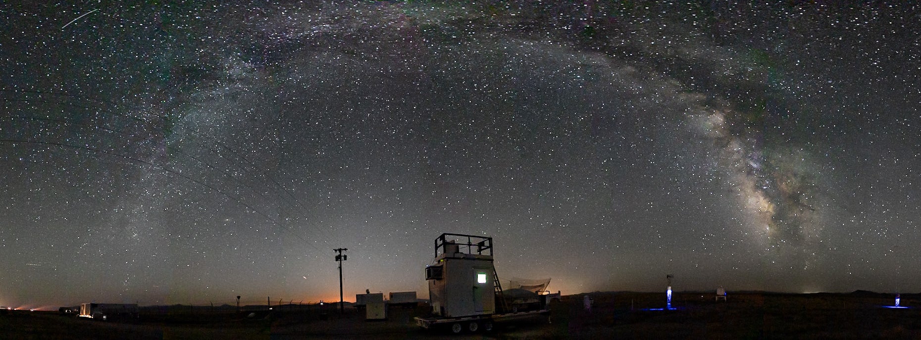
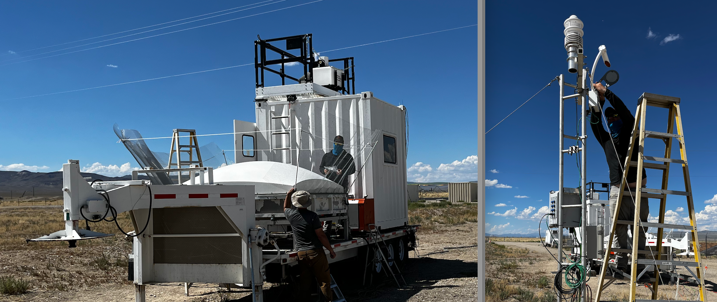
To accomplish this, the campaign deployed a large number of instruments and sensors over a large space to collect the necessary data. Staff toiled in the hot sun to erect over 50 large-scale flux towers for the Integrated Surface Flux System, which is a network of advanced weather stations. The project also utilized NCAR’s Integrated Sounding System, a meteorological observing suite of instruments that analyzes lower atmospheric thermodynamics and wind, and Micro-pulse Differential Absorption Lidar instrument that provides a profile of water vapor and temperature from earth’s surface up to about 4 kilometers high in the atmosphere.
NCAR staff also helped resurrect Chico State’s Raman-shifted Eye-safe Aerosol Lidar (REAL), an instrument that can visualize the structure of wind gusts, but which had sat idle for eight years. The data collected from REAL will complement the data from the NCAR instruments and produce a significant amount of information for the PIs and students to analyze.
NCAR scientists provided support throughout the duration of the study to ensure all the instruments were functioning optimally. They battled scorpions, black widow spiders, storms that were spun up by Hurricane Hilary, and the smell of the nearby Tonopah sewage treatment plant depending on which way the wind was blowing. The research field program ran from July through September. Because the timeline had shifted by a month, student researchers left in August to return to school. The lead PI, Tong, stayed to be involved until the study ended, teaching his classes at Clemson University via Zoom.
“Everyone was doing amazing work and it produced a substantial amount of high quality information. The PIs seemed really pleased with the amount collected,” said Isabel Suhr, EOL software engineer.
The M2HATS team is currently analyzing the data which will allow them to test their predictions and potentially improve models for severe weather prediction.