2023 year in review

A recap of NSF NCAR's top science stories

Dec 11, 2023 - by Audrey Merket

The research coming out of the U.S. National Science Foundation National Center for Atmospheric Research (NSF NCAR) in 2023 ranged from fascinating to impactful. From La Niñas and El Niños to supercomputers named after wind and the impacts of literal wind, here are the highlights of NSF NCAR’s top science stories from the past year. 

Top five stories: 

Australian bushfires put La Niña on repeat

A visualization of sea surface temperatures in the tropical Pacific in September 2020.
Sea surface temperatures in the tropical Pacific in September 2020 indicate a La Niña event. This would be the first of three consecutive La Niña winters, a rare occurrence. (Image: NOAA)

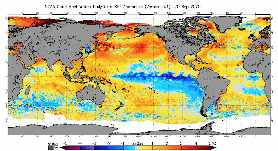
While La Niñas are not uncommon, it is rare for the occurrence to repeat for three consecutive winters. Scientists discovered that the catastrophic 2019-2020 Australian bushfires impacted the climate and nudged the Tropical Pacific into a rare multi-year La Niña event. 

It’s a bird . . .  it’s a plane . . .  it’s APAR! 

The NSF/NCAR C-130 sits in its hangar at the Research Aviation Facility in Broomfield, Colo. NCAR's new Airborne Phased Array Radar (APAR) will be mounted on this C-130 and made available to the university research community.
The NSF/NCAR C-130 sits in its hangar at the Research Aviation Facility in Broomfield, Colo. NCAR's new Airborne Phased Array Radar (APAR) will be mounted on this C-130 and made available to the university research community. (Image: UCAR)

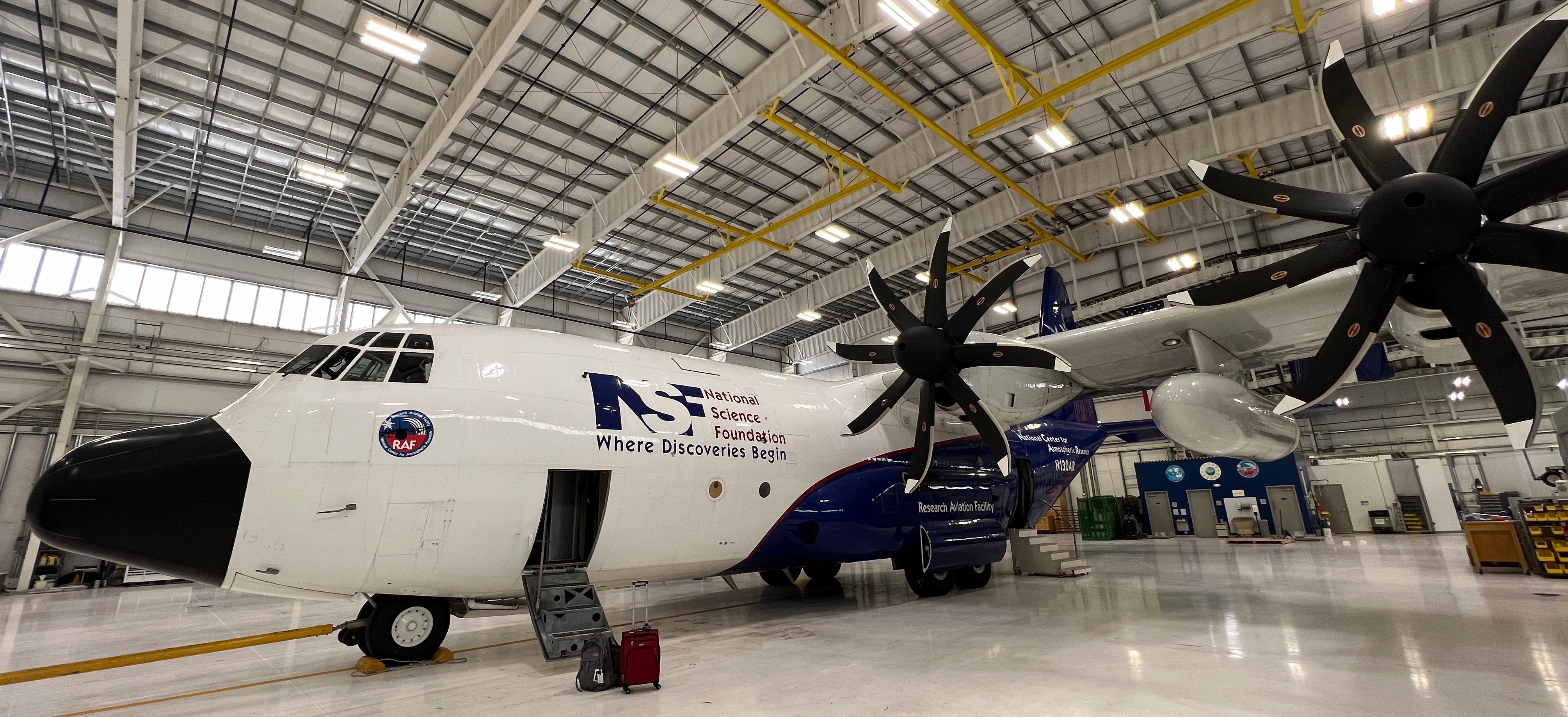
NSF NCAR’s C-130 research aircraft received funding for a new accessory: the Airborne Phased Array Radar (APAR). APAR will peer deep into storms, producing rich data that will deepen researchers' understanding of clouds, thunderstorms, and more. 

Derecho supercomputer blows everyone away

Jared Baker, a systems engineer at NWSC, displays one of Derecho's cabinets. The new supercomputer will enable major breakthroughs in Earth system science. (Image: UCAR)

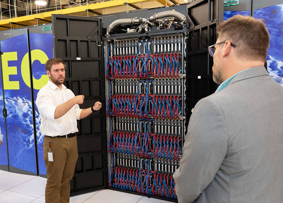
The new NSF NCAR supercomputer is 3.5 times faster and 40% more energy efficient than its predecessor. Derecho will provide researchers across the country with an important new tool to advance understanding of the atmosphere and other Earth system processes.

Super El Niño is coming

The Seasonal-to-Multiyear Large Ensemble (SMYLE) prediction system accurately hindcasted past El Niños, as shown in this graph. NCAR scientists have run the system in real time to predict the strength of this winter's El Niño, which is forecast to be on par with the 1997-98 event.
The Seasonal-to-Multiyear Large Ensemble (SMYLE) prediction system accurately hindcasted past El Niños, as shown in this graph. NCAR scientists have run the system in real time to predict the strength of this winter's El Niño, which is forecast to be on par with the 1997-98 event. (Image: UCAR)

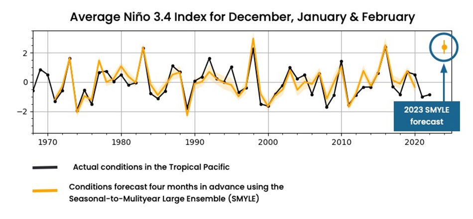
An experimental weather forecasting system predicted that one of the strongest El Niño events on record will develop this winter. Only time will tell if the system is as good at predicting future weather trends as it is at hindcasting. 

Tortoise and the hare: hurricane edition 

This NOAA GOES-16 satellite image shows Hurricane Otis shortly after it rapidly intensified to category 5 strength on October 24.
This NOAA GOES-16 satellite image shows Hurricane Otis shortly after it rapidly intensified to category 5 strength on October 24. (Image:NOAA)

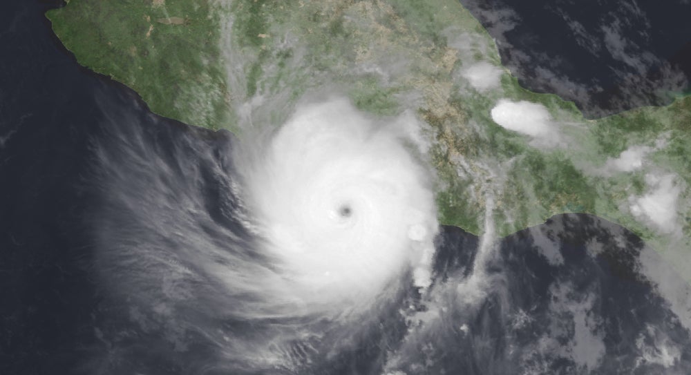
In October, the rapid intensification of Hurricane Otis from a tropical cyclone to a Category 5 hurricane caught meteorologists and residents off guard. New research explains that rapid intensification can be hard to predict because there is more than one way hurricanes intensify – as a marathon or a sprint. 

Honorable mentions

See all News