Capturing the turbulence of landfalling hurricane winds
Scientists zoom in on fine-scale movements of damaging gusts
Nov 21, 2024 - by David Hosansky
Nov 21, 2024 - by David Hosansky
| Impact statement: Modeling hurricane winds over an idealized urban environment could make it possible to predict the strength and location of gusts and eddies and in turn help coastal communities better prepare for the widely varying impacts. |
When Hurricane Milton roared onshore in Florida last month, its powerful winds shredded the roof of Tropicana Field in Tampa, which had originally been planned as a staging area for emergency responders. Other parts of the city, however, suffered much milder wind damage.
Such complex variation in powerful winds is a hallmark of landfalling cyclones. Although Milton had sustained winds of 120 miles per hour over the open waters of the Gulf, its wind patterns fractured over land when the storm ran into buildings, trees, and other features of the land surface. This kind of turbulence means that certain locations in a city may take the brunt of a hurricane’s destructive blasts.
For meteorologists, the chaotic winds raise a critical question: Is it possible to predict the strength and location of gusts and eddies to help coastal communities better prepare for their widely varying impacts?
“We’ve become a lot better at predicting tropical cyclones in terms of their track and intensity and their wind fields over the open ocean,” said Christopher Rozoff, a scientist with the U.S. National Science Foundation National Center for Atmospheric Research (NSF NCAR). “But an area we struggle with is the wind field over land. This is an emerging area of research, and right now there’s a huge push in the research community to simulate these winds and advance our understanding of how they behave.”
Rozoff and his colleagues have been using very high-resolution computer modeling for several years to simulate hurricane winds over an idealized urban environment.
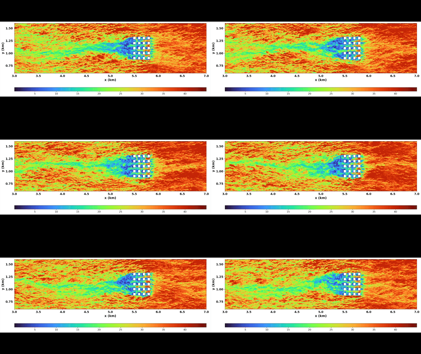
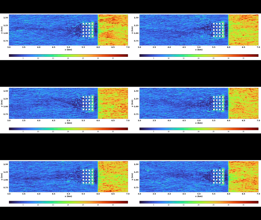
In a paper last year in the Journal of Applied Meteorology and Climatology, Rozoff and co-authors from NSF NCAR and the University of Miami in Florida showed how structures generate distinct and intricate wind patterns, tunneling and amplifying winds in urban canyons between buildings while contributing to weaker winds downstream. The research was funded by NSF and the U.S. Army Test and Evaluation Command.
As such simulations become more realistic, they can help utility crews and other emergency responders anticipate where a landfalling hurricane will cause the greatest damage. The simulations can also help urban planners design more resilient communities.

When hurricanes come onshore, even in very developed areas, radars and other instruments can’t come close to capturing every gust and eddy from ground level to the tops of buildings and higher.
To gain a more complete picture of a hurricane’s turbulent windfields, Rozoff and his colleagues used a computer model known as Cloud Model 1 developed by one of the paper’s co-authors, NSF NCAR scientist George Bryan. It simulates the atmosphere at an extraordinarily fine resolution, capturing wind movements every 2.5 meters (about 8 feet). In contrast, even a highly advanced hurricane forecasting model has a resolution of 1 kilometer (3,280 feet).
The simulations, using a simplified array of identical buildings, illuminated the intricate flow patterns of winds. One notable finding was that the spacing between the buildings significantly influences the winds. Although eddies span the canyon depths between buildings that are close together, the flow becomes far more complex and sometimes stronger when buildings are spaced farther apart.
To capture the winds in detail, the scientists applied a technique known as a large-eddy simulation, which is widely used for research into turbulence. This technique simulates larger eddies while disregarding smaller-scale ones, which are especially computationally expensive to reproduce. The modeling represented an important advance over previous studies of landfalling hurricanes that estimated wind motions instead of explicitly resolving them.
Going forward, Rozoff and his colleagues plan to use the simulations to help train machine learning models. If successful, such models will be able to capture turbulent wind flows over more detailed and larger land surfaces while minimizing demands on computational resources.
“We want to start to depict realistic land surfaces in these models to better study the fine-scale details of these very intricate winds,” Rozoff said. “The goal is to gain a fuller picture of how winds over the ocean change as they come over land and interact with buildings, trees, topography, and other land features, extending our research to a wider range of scenarios and producing vital information for at-risk communities.”
