NSF NCAR provides critical guidance to U.S. military planners
Detailed weather prediction system can protect both troops and civilians
Mar 25, 2025 - by David Hosansky
Temporary impacts to NSF NCAR Road, Parking Lot and Trails
View more information.Mar 25, 2025 - by David Hosansky
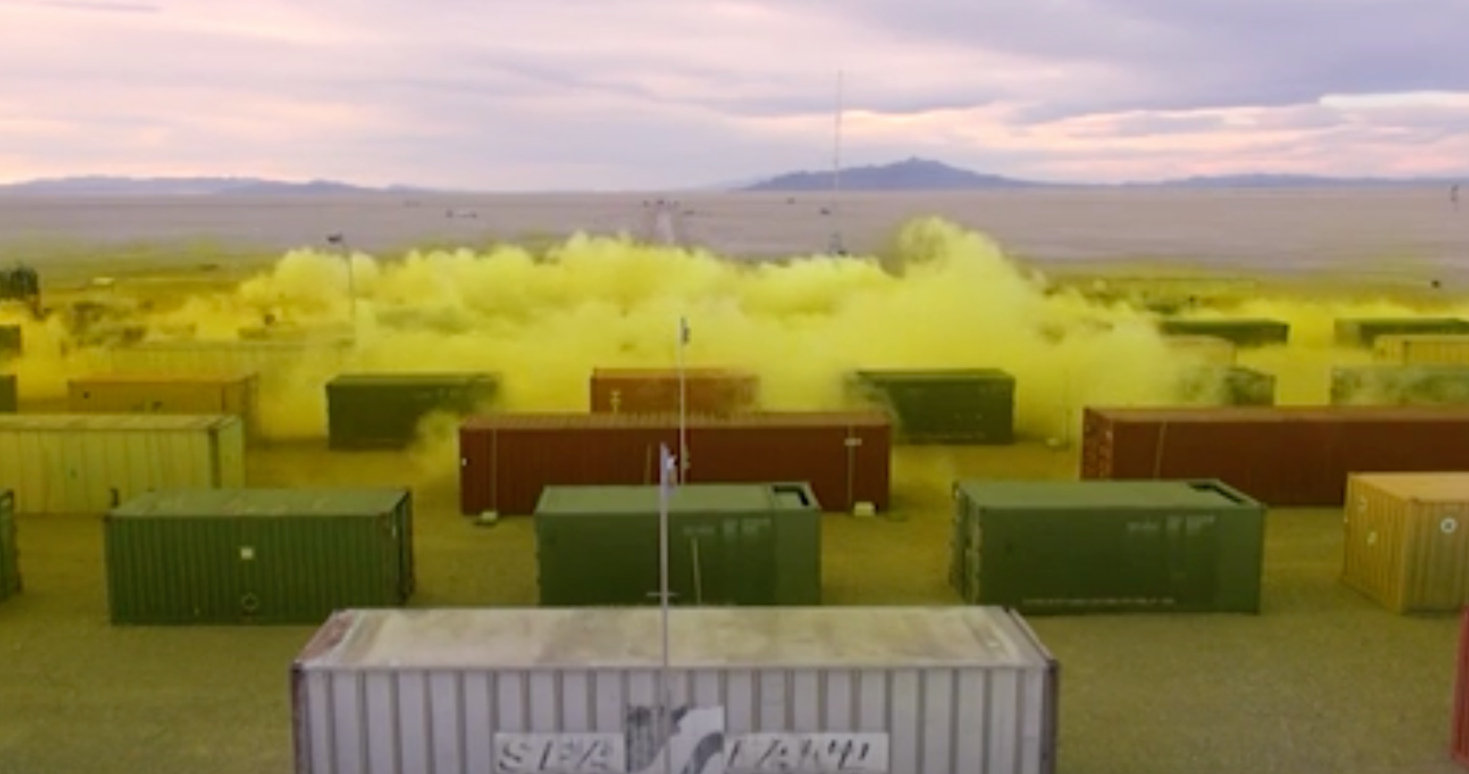
A plume of chlorine gas wafts over railroad cars in this computer simulation of a potential release of an airborne toxin. NSF NCAR scientists used GCAT to assess the typical weather at a remote Utah location for the simulation.
When U.S. military planners prepare for a future combat operation, they can access a weather prediction system that is so advanced it can project the likelihood of detailed atmospheric conditions weeks or months ahead in half-mile increments around the globe.
Scientists at the U.S. National Science Foundation National Center for Atmospheric Research (NSF NCAR) created the system, known as the Global Climatology Analysis Tool (GCAT), as part of a suite of high-technology tools that give military leaders vital intelligence about weather and climate conditions. The system can help guide a military operation and also help planners prepare for scenarios in which both troops and civilians face potential exposure to toxins released into the atmosphere.
It draws on 30 years of observations from multiple sources around the globe as well as simulations from some of the nation’s most advanced weather and climate forecasting computer models. In recent years, NSF NCAR scientists have also incorporated specialized machine learning techniques, enabling the system to rapidly generate simulations in emergencies while using less computational power.
“Weather is a critical factor in the success or failure of military operations, be they offensive or defensive,” said NSF NCAR scientist Stefano Alessandrini, who heads up the GCAT work. “By having detailed knowledge of atmospheric conditions at any point on Earth, military commanders gain an important advantage.”
GCAT is one of several notable projects that NSF NCAR has carried out for the Pentagon. Others focus on fine-scale forecasting at U.S. Army test ranges, tracking potential releases of airborne toxins, and strengthening the resilience of Space Force infrastructure to weather and climate hazards. (For more about these projects, see below).
Weather has affected American military operations since the earliest days of the nation, when George Washington’s Continental Army successfully evaded British troops on Long Island in 1776 thanks to a “providential fog” that hid their movements. Two centuries later, Dwight Eisenhower gave approval to the D-Day invasion of France on June 6, 1944, based in part on meteorologists predicting a break in stormy weather.
In order to develop GCAT and provide the U.S. military with the best possible weather information, Alessandrini and his colleagues built a massive database of 30 years of observations of atmospheric conditions worldwide. They augmented it with simulations of global climate produced by advanced NOAA computer models.
Since the observations don’t cover all points around the globe and the climate models provide only a coarse view of local conditions, the scientists had to come up with a method to fill in the gaps and provide the military with local forecasts.
They turned to the NSF NCAR–based Weather Research and Forecasting (WRF) model, an advanced tool for simulating local and regional atmospheric conditions. Using an approach called “downscaling,” they applied statistical techniques that enabled WRF to derive highly localized weather conditions from the observations and coarse weather modeling. To ensure the simulations were as accurate as possible, they adjusted them based on localized observations from weather balloons, ground-based weather stations, radars, commercial airplanes, ships at sea, and other sources.
The method allows them to capture likely atmospheric conditions around the clock for every square kilometer in the world. In addition to temperature and precipitation, the system estimates humidity, horizontal and vertical winds, turbulence, incoming and outgoing flows of solar radiation, and other specific variables that may be needed for specialized military applications or for projecting the movement of toxic plumes.
In the past year, the research team has also implemented a specialized seasonal forecasting system to provide more useful data for mission planning one to six months in advance. It draws on an ensemble of simulations from NOAA climate models, incorporating current ocean-atmosphere patterns such as El Niño, La Niña, and the North Atlantic Oscillation that influence weather patterns across much of the globe.
“Our ensemble can provide more skillful predictions than climatology alone,” said NSF NCAR scientist Scott Meech, who works with Alessandrini on national security systems. “By taking all our data about average atmospheric conditions over the last 30 years and bringing in the current state of the climate, we reduce the range of possibilities down to what is most likely to happen at every specific point on the globe.”
To make the model more efficient, Alessandrini and his colleagues have incorporated a machine learning technique known as self-organizing maps. They use this technique to extract typical days from 30 years of meteorology records, and associate those days with the probability of particular atmospheric variables such as winds. The approach enables users to rapidly run simulations of atmospheric conditions only for those days that fall under a particular classification instead of the full 30-year meteorological record.
The self-organizing maps also help identify the potential for especially high-risk situations involving a plume of hazardous material moving over a populated area. A plume is likely to be more concentrated when wind speed is too low to disperse it. GCAT has an option to pick out days in which wind speeds are low and then apply self-organizing maps to identify and categorize dangerous plume events.
“Our focus is designing these tools in a way that is as useful as possible for decision makers who need information quickly on a range of situations,” said Alessandrini. “The bottom line is these are systems that, anywhere in the world, are vital for our security.”
GCAT is just one of several projects that NSF NCAR is conducting for the U.S. military. Others include:
A system to rapidly track the accidental or deliberate release of airborne toxins. The system, funded by the Defense Threat Reduction Agency, involves running inverse computer simulations that reverse local winds from sites that have detected a hypothetical toxin. These so-called backward plume simulations are then compared with more than 1,500 forward plume simulations, developed with a type of machine learning model known as a neural network. The result can enable emergency responders in the field to almost instantaneously locate the source of the plume.
A long-time collaboration with the U.S. Army to improve forecasts at Army test ranges. NSF NCAR scientists and engineers developed a new meteorological support infrastructure called Four-Dimensional Weather (4DWX) that is so advanced it can enable predictions of atmospheric conditions on spatial scales less than a city block. The project has allowed the Army to evaluate the effectiveness of weapons systems in a broad range of atmospheric conditions and saved millions of dollars by minimizing last-minute test cancellations due to unfavorable weather.
Increasing the resilience of Space Force infrastructure to weather and climate hazards. Collaborating with Aerospace Corporation, scientists developed a prototype methodology to assess risk to individual Space Force installations, such as Cape Canaveral Space Force Station in Florida and Vandenberg Space Force Base in California. The scientists highlighted how extreme weather or other atmospheric hazards such as wildfire smoke could directly impact the base as well as the ability of key personnel to reach their posts. Scientists are also working to advance predictions of conditions in the outer atmosphere, a key region for satellites and communication and navigation systems.