Bringing real weather to classrooms
UCAR’s Unidata program helps students grasp weather as it happens
May 31, 2012 - by Staff
Temporary impacts to NSF NCAR Road, Parking Lot and Trails
View more information.May 31, 2012 - by Staff
June 1, 2012 • In order for students and their professors to study the atmosphere in detail and produce cutting-edge research that helps protect society, they need real-time data from around the nation and the globe. So campuses worldwide rely on Unidata, a UCAR-based program that keeps a 24/7 stream of weather and other environmental data flowing to classrooms.
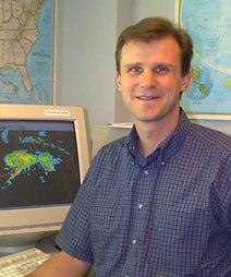
Gary Lackmann (North Carolina State University) calls on Unidata products frequently in his atmospheric science teaching. (Photo courtesy Gary Lackmann.)
Going far beyond the weather depictions available to everyone on the Web, Unidata provides heavyweight graphics and analysis tools that enable students and faculty to dissect the atmosphere and carry out innovative research. At North Carolina State University, for example, the Department of Marine, Earth, and Atmospheric Sciences includes a large number of both undergraduate and graduate students studying the atmosphere, and Unidata is an integral part of NCSU professor Gary Lackmann’s teaching.
“I use Unidata products in my classes nearly every day, in classes spanning the range from entry-level undergraduate courses to advanced graduate courses,” Lackmann says. “The ability to display and discuss what is happening now in the atmosphere makes a huge difference to the students—they can see what they are learning in action as it happens. This makes them more attentive, curious, and observant as they learn about the atmospheric sciences.”
The excitement and engagement generated through Unidata extends to many other classrooms. More than 2,400 academic institutions in some 200 nations have accessed Unidata services, and roughly 100,000 students are exposed to Unidata products each year. Among the respondents to a recent survey of people with doctorates in atmospheric science, more than half had used data or software from Unidata.
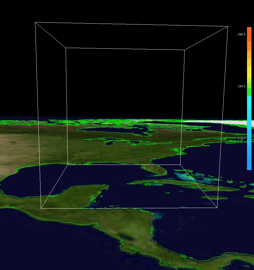
This 3-D depiction of the flow in and around 2008's Hurricane Gustav was created using Unidata's Integrated Data Viewer. Click on image to animate. (Visualization courtesy Unidata.)
“Unidata has played a transformative role in meteorological education at universities in the United States and around the world,” says Jim Steenburgh (University of Utah). He started college in 1985, when Unidata was only a year old. At that time, most campuses had a map room whose walls were lined with hard-copy weather maps—typically purple squiggles generated on facsimile paper, a technology widespread into the 1990s.
Today, Unidata’s Local Data Manager (LDM) software provides real-time data on temperatures, winds, and other observations from radar, satellite, and surface weather stations, as well as the latest forecasts from computer models. All of these can be easily displayed and analyzed on workstations and personal computers. Another piece of Unidata software, the Integrated Data Viewer, provides versatile capabilities for two- and three-dimensional mapping.
“Students can use IDV to study and forecast in our department’s computer lab, their dorm rooms, or an Internet café,” says Steenburgh.
For smaller departments, Unidata has often made a difference in program viability. “Unidata support has been essential for not only the survival of our program, but also its growth,” says James Koermer (Plymouth State University). Plymouth State added a master’s program in applied meteorology in 2005, which helps prepare students for work in aviation, air pollution, and other high-impact areas. “Nearly all of the M.S. research projects have been aided by Unidata-supported software packages. These also reach into the undergraduate level, not only for instructional use by faculty, but also for many lab exercises as well as undergraduate research," Koermer says.
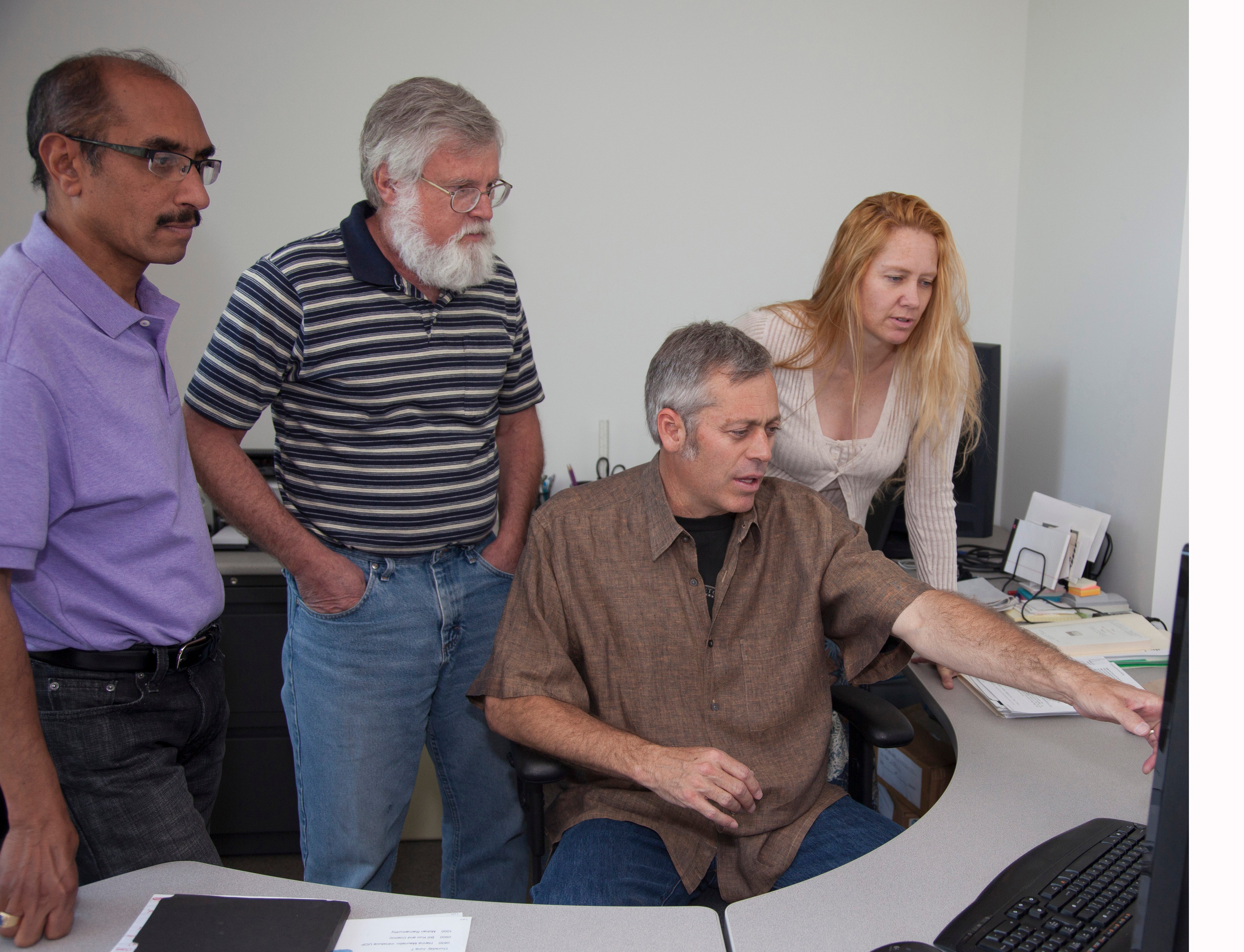
The Unidata team at UCAR includes (left to right) director Mohan Ramamurthy, software engineer Tom Yoksas, project manager Jeff Weber, and software engineer Jennifer Oxelson. (©UCAR. Photo by Carlye Calvin. This image is freely available for media & nonprofit use.)
“To me, the clearest demonstration of Unidata’s impact is when we are taken for granted,” says the program’s director, Mohan Ramamurthy. “That’s when you know you’ve become part of the fabric of education.”
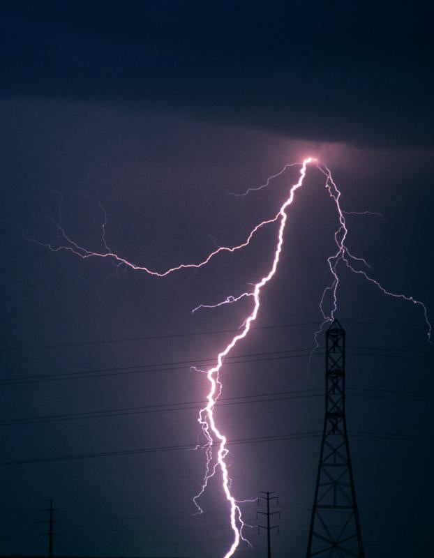
Unidata brings a variety of lightning detection data to students and faculty. (©UCAR. Photo by Carlye Calvin. This image is freely available for media & nonprofit use.)
Unidata was UCAR’s first major project beyond managing NCAR. Predating the Internet, it was formed with NSF support at the request of universities when budget cuts triggered the loss of free teletype and facsimile circuits that delivered weather data from the National Weather Service.
The name Unidata was coined by John Dutton (Pennsylvania State University), who served as principal investigator with the late Vernon Suomi (University of Wisconsin–Madison).
Initially based on satellite and telephone transmission, Unidata’s services shifted to the Internet as the latter gained traction at universities. The program also relies heavily on a decentralized model in which universities themselves host and relay much of the data, with Unidata managing the process and setting protocols. Faculty serve on steering committees and volunteer in other ways to foster community collaboration and a vibrant program.
Unidata has also linked the private sector with academia in beneficial ways. For example, the nation’s two main sources of data on lightning strikes—the National Lightning Detection Network (NLDN) and the U.S. Precision Lightning Network (USPLN)—sell their data to clients, so the real-time information isn’t generally available on the Internet. However, the two vendors, Vaisala and WSI Corporation, agreed to make the lightning data available to students and faculty through a Unidata-facilitated arrangement, with the NLDN data routed through the University at Albany, State University of New York. Users agree not to share the data beyond their campuses.
“The lightning feed is an excellent example of how the Unidata community operates with integrity. They have adhered to the redistribution restrictions for years,” says Unidata software engineer Tom Yoksas. “This serves as a model for others who want to distribute data for research and educational purposes while retaining commercial rights.”
In this 2010 photo, John Molinari (University at Albany, State Univerity of New York) meets with graduate students Diana Thomas (now at the firm Natural Power) and Leon Nguyen. (Photo by Mark Schmidt, courtesy University at Albany.)
At the University at Albany, Kristen Corbosiero has used the data to validate the accuracy of the new World Wide Lightning Location Network, based at the University of Washington, and she and colleague John Molinari have employed the data to study hurricane evolution.
“We have written numerous papers using NLDN lightning in tropical cyclones,” says Molinari. “It is a great resource.” Hundreds more studies have drawn on Unidata-facilitated data feeds to improve the understanding of high-impact weather and move the science toward better forecasts.
Unidata’s suite of offerings will expand further by 2013, when university students and faculty will be able to access the same open-source graphics interface soon to be used by National Weather Service forecasters. The interface, called AWIPS II (Advanced Weather Interactive Processing System II), is now being tested at NWS offices. It will help students hone their forecasting skills and gain a better understanding of how deadline-driven NWS forecasters carry out their work.
AWIPS II will also include data from the Space Weather Prediction Center, which could help expand Unidata’s user base to include solar specialists. (See related article.) “I would like to see the space weather research and university communities be able to take advantage of the same programs the terrestrial weather community has been offered through Unidata,” says SWPC space weather services branch chief Brent Gordon. “Bringing space weather to AWIPS II is the first step in this process, and I’ll be excited to see how the community responds.”
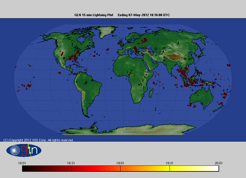
This loop shows two hours of lightning-stroke data on May 7, 2012, collected from the Global Lightning Network and mapped at 15-minute intervals. A product of WSI, the network draws from more than 150 detection sites around the world. Unidata has teamed with vendors WSI and Vaisala to make data from this and several other lightning detection networks available for education and research at Unidata-affiliated campuses. (Image courtesy WSI.)