Reservoirs beneath our feet
Will underground aquifers keep us well watered?
Aug 13, 2012 - by Staff
Temporary impacts to NSF NCAR Road, Parking Lot and Trails
View more information.Aug 13, 2012 - by Staff
August 13, 2012 | One of the largest bodies of water in the United States can’t be seen from the air. It stretches from Nebraska to Texas, and it helps produce $35 billion in wheat, corn, and other agricultural products each year. But the vast Ogallala Aquifer isn’t on the radar of Rand McNally or Google Maps, because it lies underground.
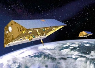
The Gravity Recovery and Climate Experiment (GRACE) measures changes in the mass of water and other Earth-system components by tracking tiny changes in the gravitational pull exerted on its twin satellites. (Image courtesy Astrium.)
The Ogallala is part of an array of aquifers around the world that help provide food, water, and energy for millions of people. Much like oil and gas reserves, the bounty of an aquifer can seem endless until its flow begins to slacken. A revolutionary satellite system is giving scientists a far better idea of where aquifers are being depleted the most quickly—vital data for helping manage these enormous but ultimately limited resources.
The twin satellites known as GRACE, the Gravity Recovery and Climate Experiment, have been tracking Earth’s gravitational field in detail since 2002. Led by German science agencies, NASA’s Jet Propulsion Laboratory, and the University of Texas at Austin, GRACE measures tiny gravity-induced changes in the tracks of its satellites, which allows scientists to infer changes over time in ocean currents, glaciers, and other geophysical features.
“GRACE has shown us that the human fingerprint on the water landscape is extremely strong,” says Jay Famiglietti, who directs the Hydrology & Climate Research Group at the University of California, Irvine.
Famiglietti is part of a group of scientists who’ve spent years unraveling GRACE data to deduce how aquifers are changing. The only sure way to verify an aquifer’s depth at any given point is to drill into it. That’s been done courtesy of some 9,000 wells tapping into the water of the Ogallala, which is among the world’s best-characterized aquifers. The depth and volume of many other aquifers isn’t known. But GRACE can monitor changes even without knowing an aquifer's total storage.
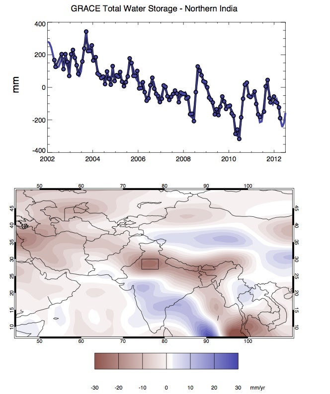
Satellite data suggests that depletion of northern India's aquifers has continued since NCAR’s Sean Swenson and colleagues published a 2009 analysis. The map above shows the change in total water storage as measured by the GRACE satellite between 2002 and 2012. The graph shows trends for the strongly depleted area in northern India within the box outlined on the map. Year-to-year changes in the monsoon play a large role in the rate of aquifer use, along with increased development and other factors. (Images by Sean Swenson, NCAR.)
“We already knew that groundwater is being depleted in these aquifers,” says Famiglietti. “GRACE allows us to quantify the rates of depletion, which is very difficult to do on the ground and almost impossible to do internationally.”
Sean Swenson. (©UCAR. Photo by Carlye Calvin. This image is freely available for media & nonprofit use.)
When NCAR’s Sean Swenson was a graduate student at the University of Colorado Boulder, he developed techniques to reduce errors in GRACE data and greatly improve its spatial resolution. Swenson now focuses on development of NCAR’s Community Land Model, but he’s often asked to participate in GRACE-related research.
In 2009, Swenson collaborated on a study led by V.M. Tiwari (National Geophysical Research Institute, India) concluding that groundwater in northern India had been depleted by roughly 54 cubic kilometers (13 cubic miles) per year between 2002 and 2008, perhaps the most rapid loss on Earth for an area that size. “This is probably the largest rate of groundwater loss in any comparable-sized region on Earth," the study noted. With India’s monsoon weaker than normal this year, it’s been suggested that the energy associated with aquifer pumping helped trigger power outages that affected hundreds of millions of people across northern India in late July.
Swenson and Famiglietti are collaborating on another study, now in review, examining groundwater depletion in a drought-prone area spanning parts of Turkey, Iraq, and Iran. Swenson is also working with Famiglietti’s former Ph.D. student, Min-Hui Lo (National Central University, Taiwan), to develop models of aquifer loss that GRACE and other data can help verify.
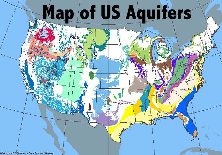
This map shows the locations of major aquifers in the contiguous 48 states. The Ogalalla Aquifer is shown in pale blue, stretching from Nebraska south to Texas. California’s Central Valley aquifer system is shown in darker blue at far left. (U.S. National Atlas map courtesy Mission 2012: Clean Water.)
Within a single aquifer, there can be enormous variation. A recent study led by Bridget Scanlon (University of Texas at Austin) analyzed depletion rates for the Ogallala and for the aquifer system that supports agriculture across California’s fertile Central Valley.
The Ogallala’s situation is the more dire of the two. The north end of this aquifer, beneath western Nebraska, is replenished by water descending from the Platte River system through sandy soil. Here, irrigation demands are relatively modest. Further south, there’s very little recharge from surface water, and fine-grained soils help keep rain and snow from percolating downward. Some of the “fossil” groundwater used to irrigate crops in western Kansas and Texas may date back to the last ice age, more than 13,000 years ago.
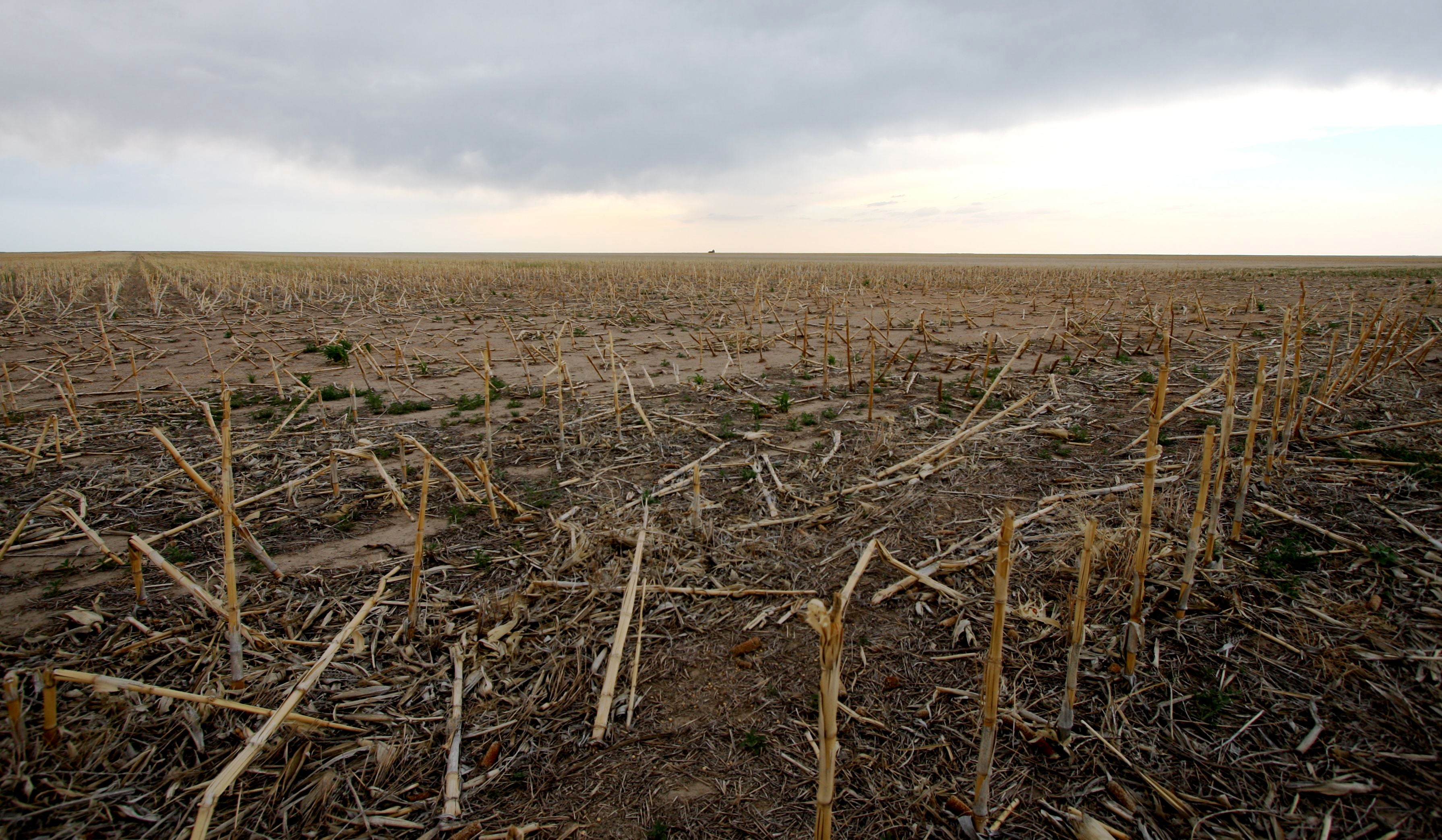
Corn stalks from the previous year’s harvest lie atop parched fields in northeast Colorado in early June 2012. Many of the crops grown in the region rely on irrigation from the vast Ogallala Aquifer. (©UCAR. Photo by Bob Henson. This image is freely available for media & nonprofit use.)
Extrapolating from recent depletion rates, Scanlon and colleagues found that some parts of the southern Ogallala may essentially run dry within the next 30 years. That doesn’t necessarily doom farmers; only about 30% of the region’s crops are irrigated, and many farmers would shift to less-thirsty crops as needed. However, the overall stress on water supply would undoubtedly soar.
At Michigan State University, Bruno Basso has been examining the effects of Ogallala depletion and climate change on agriculture. He is also investigating the potential impact of adaptation strategies farmers could use to improve soil quality, crop yield, and water use efficiency. The strategies studied by Basso include using water-sipping no-till techniques, optimizing the mix of plants, altering planting dates, and employing new cultivars not yet developed but simulated in crop modeling. These approaches could help keep crop yields from plummeting, says Basso, although he stresses that economic and climatic uncertainties will shape how farmers ultimately act.
As opposed to the Ogallala, there's more flexibility in managing water across California’s Central Valley, where rain and snowmelt from the Sierra Nevada helps recharge the aquifer system. Since the 1960s, a set of groundwater banks built within the Tulare River basin has gathered water during wet years and sent it underground, to be pumped back up as needed during dry years. In the Central Valley, “Groundwater banking offers great promise for more sustainable management of groundwater," the study by Scanlon and colleagues concludes.
Yet climate change remains a question mark for central California’s aquifers. If precipitation simply became more variable, without increasing or decreasing in the long term, then groundwater banking would be well suited for adapting to that shift. But putting water underground and pulling it back out is an energy-intensive endeavor. And it’s possible that the total amount of rain and snow might decrease, especially toward southern parts of the state.
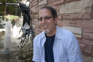
Water expert Jay Famiglietti (University of California, Irvine) is conducting a 50-lecture tour this year sponsored by the American Geophysical Union. (©UCAR. Photo by Bob Henson. This image is freely available for media & nonprofit use.)
There’s no doubt that on-and-off drought since around 2000 has taken a toll on water supplies across the U.S. Southwest, including lakes Mead and Powell, which were running at 50-60% of capacity in recent weeks. In a 2011 study, Famiglietti and colleagues estimated that the aquifers beneath California’s Sacramento and San Joaquin River basins had lost nearly enough water in seven years to fill Lake Mead.
Beyond the concerns in his own part of the world, Famiglietti is communicating about global pressures on water access in several ways. Later this year, he plans to publish the first GRACE-derived global map of aquifer trends. Right now Famiglietti is in the midst of a 50-week, 50-lecture global tour called Water 50/50, supported by the AGU’s Birdsal-Dreiss Distinguished Lectureship. He’s also one of the featured scientists in a major documentary on water issues, Last Call at the Oasis, released earlier this year. Among his key messages in the film is a call to map out Earth’s water resources as thoroughly as its oil and gas resources have been charted.
“Nationally and internationally,” he says, “we need to push for a thorough exploration of Earth’s water environment.”