Field campaign flies through icy weather
Scientists study dangerous flight conditions
Feb 22, 2019 - by Ali Branscombe
Early closure on July 3 and 4 - NSF NCAR Road, Parking Lot and Trails
View more information.Feb 22, 2019 - by Ali Branscombe
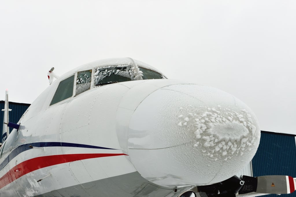
Ice buildup on the NRC Convair 580 can be seen on the aircraft nose and windows after a flight to collect data on ice-prone weather conditions. (©UCAR. Image: Scott Landolt/NCAR)
Winter in the United States can produce some of the most dangerous weather for the aviation industry, including freezing rain, freezing drizzle, and sleet. Those are the ideal conditions for a field campaign focused on collecting in-flight data in some of the most treacherous North American icing conditions.
The program is led by the Federal Aviation Administration (FAA), in partnership with the National Center for Atmospheric Research (NCAR) and other organizations, and will help improve weather models and forecasts for those who work in aviation.
"Icy weather conditions are a hazard to pilots, crew, and passengers around the world," said Scott Landolt, an NCAR scientist and co-lead principal investigator for the field campaign. "This research will help make flight transportation safer, especially for smaller aircraft that fly at lower altitudes where they are at a higher risk of ice buildup during flight."
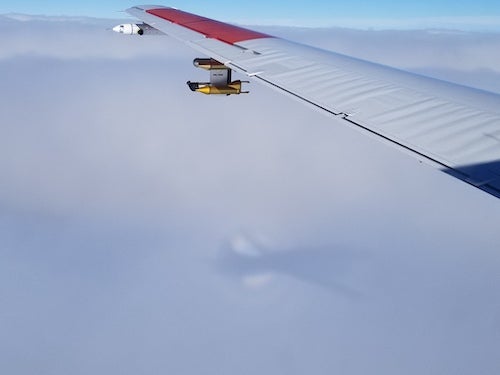
Scientists with the In-Cloud Icing and Large-Drop Experiment (ICICLE) have been flying through extreme winter weather conditions since Jan. 28 using the National Research Council of Canada's (NRC) Convair 580, a twin-engine research aircraft. Based in Rockford, Illinois, the scientists and Convair crew will travel to Wisconsin, Michigan, Iowa, and other neighboring states for another two weeks, chasing icy weather conditions.
This project is part of the FAA’s Aviation Weather Research Program, which sponsors research that will help minimize the impact of weather on the National Airspace System, including turbulence, ceiling and visibility, thunderstorms, and aircraft icing. “Aviation users can only operate in icing conditions for which the aircraft is certified. If an aircraft demonstrates it can operate safely in a particular icing environment, it can become certified for flight into those icing environments," said Stephanie DiVito, the FAA ICICLE program lead and terminal area icing project lead. "Any icing environment outside of those provisions must be avoided. In order to avoid icing, the user must know it exists.”
“The data from ICICLE will help develop and validate icing diagnosis and forecast tools for the identification of icing conditions an aviation user may encounter, both in the terminal and en route environments, to enable safe operations in the National Airspace System,” said Danny Sims, the FAA in-flight icing weather project lead.
The data collected during ICICLE will be used to improve weather models and tools used in icing diagnosis and forecasting. Improving and drawing upon the strengths of these weather tools the aviation industry relies on could help pilots avert risky situations, like ice buildup.
Ice buildup on the surface of an aircraft can occur on the ground or in-flight. When it happens on the ground, an aircraft must be de-iced before takeoff. During a flight, ice can form when an aircraft flies through supercooled liquid water — water that remains liquid in the atmosphere at temperatures well below freezing.
“The risk to aviation in these conditions is that as soon as an airplane flies through this cloud, the supercooled droplets will freeze on impact,” said Julie Haggerty, who leads the in-flight icing program at NCAR and is co-lead principal investigator for ICICLE. “Airplanes are shaped to be aerodynamically functional, and when you add ice this changes the shape of the airplane and the airflow. Suddenly the airplane doesn’t fly as it is supposed to.”
The goal of the field campaign is to capture the various environments in which supercooled liquid water can exist in winter conditions aloft and to produce a data set that cannot be gathered from weather stations on the ground. The scientists are particularly interested in studying large water drops, typically bigger than what is seen in foggy weather.
“Getting something correct at the surface is insufficient. We need the observations in the sky as well because that is where the water droplets affect the airplanes once they are off the ground,” said Greg Thompson, an atmospheric scientist at NCAR who is working on ICICLE.
While the focus is on the in-cloud conditions, the scientists will be collecting data through the entire flight process, said Landolt. “We are trying to cover the full spectrum of what a pilot goes through when they are doing their planning — what the conditions are at their current airport location, what to expect during takeoff, en route, and then landing,” he said.
Throughout the field project, scientists and flight crew begin work on the flight plan in the early morning. Forecasters start looking at weather conditions as early as midnight and, through university partnerships, occasionally release weather balloons to analyze the cloud structure. The team uses the forecasts to plan the flight altitude and route to best capture the in-cloud conditions. Even if there is no precipitation, the crew will be flying.
“The majority of clouds you see outside aren’t producing precipitation, but when an aircraft takes off it has to fly through the cloud, and it will encounter ice-prone conditions there,” said Landolt.
Throughout takeoff, flight, and landing, instruments mounted on the airplane are collecting measurements. A suite of sensors, provided by the NRC and Environment and Climate Change Canada, measures a range of particle sizes while optical sensors count the number of droplets and ice crystals in the cloud along the flight path. In addition, an onboard cloud radar will allow the scientists to characterize the clouds above, below, and ahead of the aircraft.
This in-flight data will be compiled with NCAR’s Earth Observing Laboratory field catalog, a suite of tools that record ancillary data each day of the campaign. Scientists from around the world can use the catalog in real time and long after the field campaign is finished to help visualize the entirety of the project. The catalog includes maps, satellite and radar observations, and surface conditions among many other products.
ICICLE includes essential participation by NCAR, a major facility of the National Science Foundation, as active icing researchers in support of FAA icing projects and participating in ICICLE as support scientists, forecasters, and operations directors. In addition, Ben Bernstein, a consultant with Leading Edge Atmospherics, LLC is a critical part of the team, serving as science lead for the team and primary operations director, while providing expertise in identifying and sampling conditions that cause ice buildup. ICICLE further includes collaborators from the National Oceanic and Atmospheric Administration as well as groups in England, France, and Germany.
Please visit ICICLE for more information.