UCAR licensing agreement with AER will boost use of GNSS satellite data
The resulting information will help companies improve custom forecasts
Mar 9, 2020 - by David Hosansky
Temporary impacts to NSF NCAR Road, Parking Lot and Trails
View more information.Mar 9, 2020 - by David Hosansky
The University Corporation for Atmospheric Research (UCAR), building on its commitment to improve weather forecasting, will license a satellite data processing system to Atmospheric and Environmental, Inc. (AER). The agreement will enable AER to process satellite data for commercial companies that sell their Earth observation data products to government agencies and other organizations that provide customized environmental information to a range of clients.
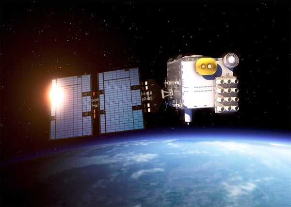
Under the agreement, AER will adapt UCAR's SatDAAC® software system to process observations from satellites that use a method known as Global Navigation Satellite System (GNSS) radio occultation to observe the atmosphere. Those observations can lead to significantly improved weather forecasts, in part because they accurately measure water vapor – a critical driver of powerful storms – at different heights in the atmosphere.
"This type of alliance with the private sector is instrumental for adding value to weather forecasting and protecting lives and property, " said UCAR President Antonio Busalacchi. "By transitioning publicly funded research to industry, we are ensuring that the latest scientific advances are leveraged in ways that help society and keep the nation economically competitive."
“AER is excited to embark on this collaboration with UCAR to offer services based upon the proven SatDAAC processing system in a commercial mode to companies operating GNSS radio occultation satellites,” said AER President Guy Seeley. “Our decades of experience serving both government and commercial clients in high-performance satellite remote sensing, combined with our outstanding technical and scientific team, will enable us to rapidly provision state-of-the-art processing capabilities as requirements and methods evolve in this fast-moving new industry.”
GNSS radio occultation measures the extent to which the radio signals from GNSS transmitter satellites (including GPS satellites) bend and slow as they descend through denser regions of the atmosphere.
The measurements can be further processed into information about temperature, pressure, and humidity in the lower atmosphere, as well as the number of electrons in the ionosphere. This provides considerable knowledge about a large volume of the atmosphere from near-Earth orbit down to the surface.
NASA's Joint Propulsion Laboratory had used radio occultation to provide the first atmospheric measurements of the outer planets in the 1960s. UCAR pioneered the GNSS radio occultation observing technique for Earth's atmosphere, building on basic research with funding from the National Science Foundation.
In 2006, UCAR began producing operational GNSS radio occultation data from a specialized constellation of small satellites known as the Constellation Observing System for Meteorology, Ionosphere, and Climate (COSMIC). The observations from COSMIC led to improved predictions of tropical cyclones and other storms, as well as information about space weather and global climate.
A second constellation of small satellites, known as COSMIC-2, was launched this June. It will provide twice as many soundings of the atmosphere with higher quality than COSMIC.
Now that the technology has been successfully demonstrated, additional satellites with GNSS radio occultation technology are being launched.
"This technology has moved quickly from being a research concept to providing vital information to forecasters," said Ying-Hwa "Bill" Kuo, director of the UCAR Community Programs. "The original investment in basic research is generating substantial benefits for society."
The UCAR-AER agreement will likely lead to further advances in GNSS radio occultation technology, according to Bill Schreiner, director of the UCAR COSMIC Program.
"By transferring technology to the private sector, AER can take it to the next level in terms of distributing the data and finding new applications that help society," he said. "This agreement will leverage SatDAAC’s advanced capabilities to develop new products for use by the environmental observing and prediction communities, and will help us continue to innovate."
AER works with governments and businesses worldwide to advance understanding of climate- and weather-related risks. The company develops analytical tools to help measure and observe the properties of the environment and translate those measurements into useful information.