Earth Science Week 2015: NCAR visualizes Earth, air, fire & water
NCAR's visualizations make research come alive
Oct 12, 2015 - by Staff
Temporary impacts to NSF NCAR Road, Parking Lot and Trails
View more information.Oct 12, 2015 - by Staff
October 12, 2015 | We're excited it's Earth Science Week, and even more excited about this year's theme—visualizing Earth systems—because it happens to be one of the things NCAR does best. NCAR visualizations cover the spectrum, from Earth to air to fire to water.
 |
 |
 |
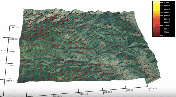 |
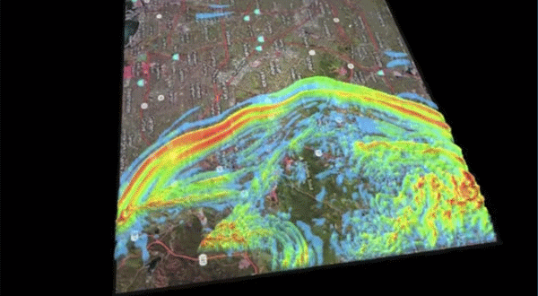
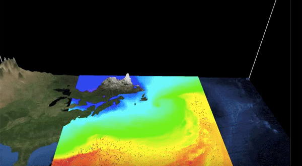
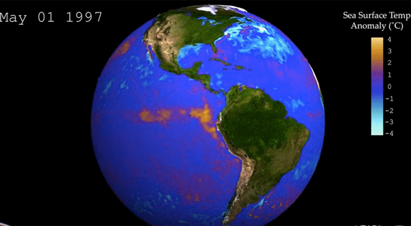
Clockwise from top left: EARTH (ground movement for an earthquake in California), AIR (wind trajectories during a marine cyclone), FIRE (behavior of a Colorado wildfire), and WATER (sea surface temperature anomalies during El Niño and La Niña). Click on the images to watch the full video versions of the simulations.
Scientists across NCAR and at collaborating universities create visualizations to help make sense of their research, often with the help of the Computational and Information Systems Lab. CISL houses the VisLab (the Scientific Visualization Services Group), VAPOR (the Visualization and Analysis Platform for Ocean, Atmosphere and Solar Researchers group); and NCL (the NCAR Command Language group). These teams of software engineers and other professionals are resources for scientists who want to make their research come alive. Learn more about how the visualizations are made here.
Earth Science Week was launched by the American Geosciences Institute in 1998. #EarthSciWeek 2015 runs from Oct. 11 through Oct 18.
Writer/contact
Laura Snider, Senior Science Writer and Public Information Officer