-

Cloud droplets in 3D
The HOLODEC instrument uses a laser light to take a 3D image of the droplets inside a cloud.
- Weather
-
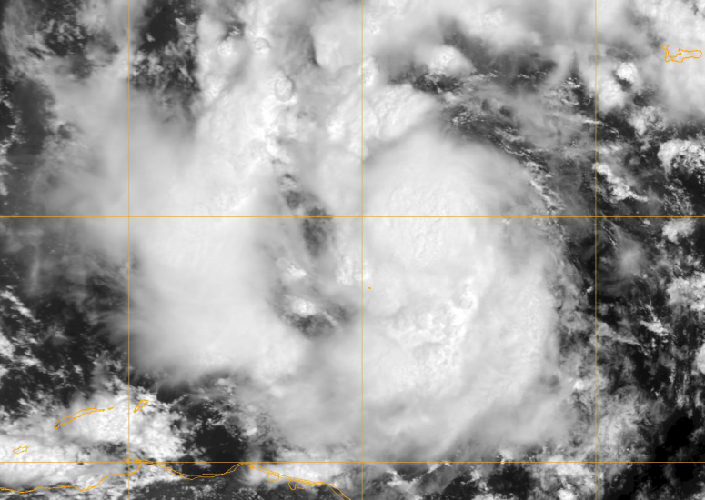
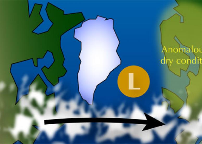
A cool setting for hurricane births
Research may shed light on why some clusters of thunderstorms spin up into tropical storms while others dissipate.
- Weather
-
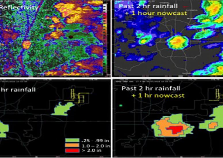
NCAR "STEPs" up rain, flood research
Scientists are running several computer models simultaneously to provide more accurate short-term forecasts of heavy rainfall, flash floods.
- Data,
- Weather
-
Revealing Europe's winter weather history
The research could move scientists closer toward projecting weather patterns in Europe months to years in advance.
- Climate,
- Weather
-
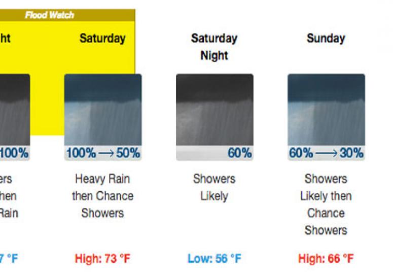
Picturing the forecast: National Weather Service graphics developed with NCAR research
Introduced by the NWS this summer, the graphics draw on research by a team of risk communication experts at NCAR.
- Weather