-
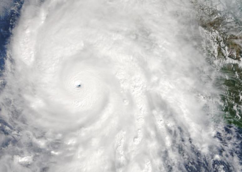
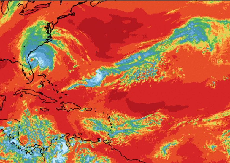
High-res model captures explosive increase in hurricane strength
An advanced version of the Weather Research and Forecasting model (WRF-ARW) accurately forecast Hurricane Patricia's rapid intensification when run at a high enough resolution.
- Weather
-
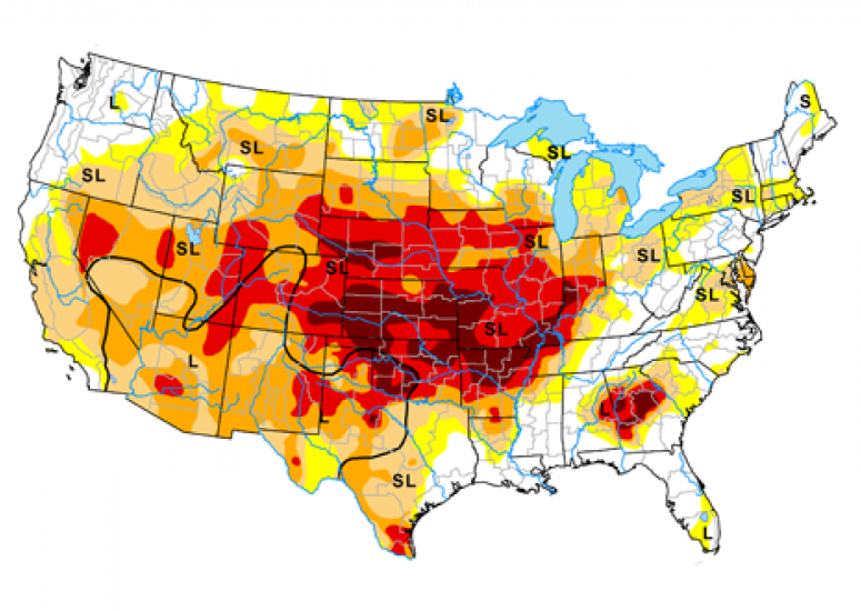
Soil moisture, snowpack data could help predict 'flash droughts'
New research suggests that "flash droughts" — like the one that unexpectedly gripped the Southern Rockies and Midwest in the summer of 2012 — could be predicted months in advance using soil moisture and snowpack data.
- Weather
-
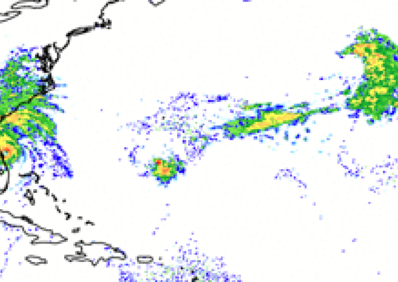
Advanced computer model focuses on Hurricane Matthew
As Hurricane Matthew churns toward the southeastern U.S. coast, NCAR scientists study how well MPAS can predict it.
- Weather
-
UCAR congressional briefing highlights flood, drought prediction
Experts discuss more detailed forecasts of floods, streamflow, and potential drought conditions,
- Government Relations,
- Water,
- Weather
-
NCAR|UCAR hurricane experts available to explain storm behavior, impacts
Scientists at the National Center for Atmospheric Research (NCAR) and its managing organization, the University Corporation for Atmospheric Research (UCAR), use advanced computer models and observations to study how tropical storms behave and their impacts on society.
- Weather