-
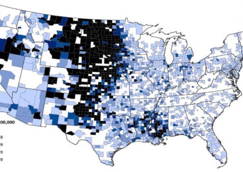
Biting back: Scientists aim to forecast West Nile outbreaks
CDC and NCAR researchers find correlations across the U.S. between weather conditions and subsequent flareups of the virus.
- Weather
-
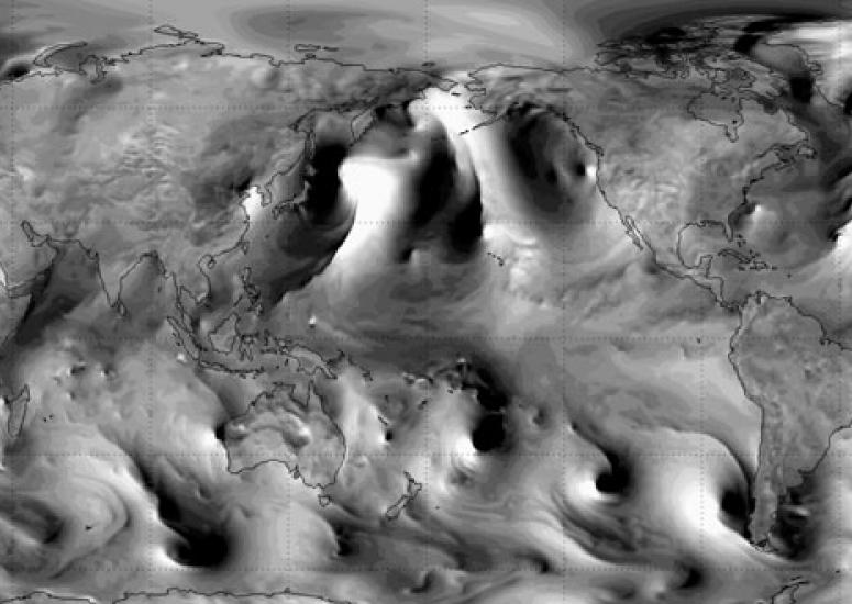
Watch invisible waves rumble through the atmosphere
For the first time, an NCAR-led team of scientists have found a way to simulate the propagation of gravity waves toward space. The resulting visualization is mesmerizing to watch.
- Weather
-
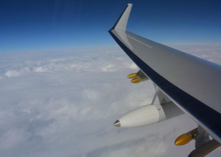
Nor’easter on the radar
Scientists flew the new HIAPER Cloud Radar above a major northeast snowstorm, obtaining critical data on its structure and dynamics.
- Weather
-
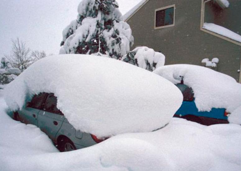
Snowfall measurement: a flaky history
Many storms from the 1980s or earlier would probably appear in the record as bigger storms if the observers had used currently accepted methodology.
- Weather
-

A meeting for storm-driven science
Experts from Asia and North America met at NCAR on September 15–18 to discuss promising avenues of research that could lead to improvements in predicting hurricanes, floods, and other phenomena affecting billions of people.
- Weather